Area Overview for L35 2UJ
Photos of L35 2UJ
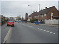
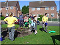
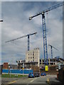
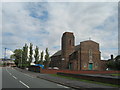
36 photos from this area
Area Information
Key information about the L35 2UJ including its size, population, and administrative classification.
- Area Type
- Postcode
- Area Size
- 1.4 hectares
- Population
- 1928
- Population Density
- 4277 people/km²
House Prices in L35 2UJ
65
Properties
£75,019
Average Sold Price
£15,000
Lowest Price
£130,000
Highest Price
Showing 65 properties
| Address | Type | Beds | Baths | Last Sale Price | Last Sale Date | |
|---|---|---|---|---|---|---|
| 41 Cook Street, Whiston, L35 2UJ | Terraced | 3 | 1 | £130,000 | Feb 2025 | |
| 54 Cook Street, Whiston, L35 2UJ | Terraced | 2 | 1 | £93,500 | Mar 2024 | |
| 42 Cook Street, Whiston, L35 2UJ | Terraced | 2 | 1 | £84,200 | Oct 2023 | |
| 50 Cook Street, Whiston, L35 2UJ | house | 2 | 1 | £100,000 | Aug 2023 | |
| 12 Cook Street, Whiston, L35 2UJ | Terraced | 2 | 1 | £85,000 | Jun 2022 | |
| 33 Cook Street, Whiston, L35 2UJ | Terraced | 3 | 1 | £87,000 | Jun 2021 | |
| 32 Cook Street, Whiston, L35 2UJ | Terraced | 2 | 1 | £60,000 | Jan 2020 | |
| 36 Cook Street, Whiston, L35 2UJ | Terraced | 3 | 1 | £77,000 | Oct 2019 | |
| 46 Cook Street, Whiston, L35 2UJ | Terraced | - | - | £53,000 | May 2018 | |
| 6 Cook Street, Whiston, L35 2UJ | Terraced | 2 | 1 | £63,000 | Jul 2016 |
Page 1 of 7
Energy Efficiency in L35 2UJ
Amenities
Schools
| Rank | School | Type | Entry gender | Ages |
|---|
Explore more schools in this area
Go to Schools tabDemographics
Household Size
Family (3-5 people)
most common
Accommodation Type
Houses
most common
Tenure
71
majority
Ethnic Group
White
most common
Religion
N/A
most common
Household Composition
N/A
most common
Age
47
median
Adults (30-64 years)
most common
Household Deprivation
N/A
with no deprivation
NS-SEC
36
in Lower managerial occupations
Explore more demographic insights in this area
Go to Demographics tabPlanning
Planning Constraints
- Flood RiskPremium
- Ramsar Wetland SitesPremium
- Area of Outstanding Natural BeautyPremium
- Protected Nature ReservePremium
- Protected WoodlandPremium