Area Overview for L34 6JD
Photos of L34 6JD

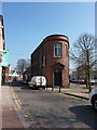
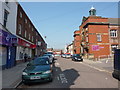
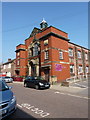
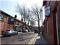
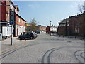
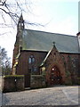
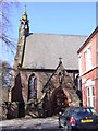
82 photos from this area
Area Information
Key information about the L34 6JD including its size, population, and administrative classification.
- Area Type
- Postcode
- Area Size
- 2516 m²
- Population
- 1490
- Population Density
- 4694 people/km²
House Prices in L34 6JD
25
Properties
£86,441
Average Sold Price
£42,500
Lowest Price
£127,500
Highest Price
Showing 25 properties
| Address | Type | Beds | Baths | Last Sale Price | Last Sale Date | |
|---|---|---|---|---|---|---|
| 23 Duke Street, Prescot, L34 6JD | Terraced | 2 | 1 | £127,500 | Jul 2025 | |
| 4 Duke Street, Prescot, L34 6JD | Terraced | 2 | 1 | £115,000 | Jul 2024 | |
| 14 Duke Street, Prescot, L34 6JD | Terraced | 2 | 1 | £117,500 | Jan 2024 | |
| 18 Duke Street, Prescot, L34 6JD | Terraced | 2 | 1 | £110,000 | May 2023 | |
| 16 Duke Street, Prescot, L34 6JD | Terraced | 2 | 1 | £79,500 | Jan 2023 | |
| 11 Duke Street, Prescot, L34 6JD | house | 2 | 2 | £86,500 | Nov 2019 | |
| 5 Duke Street, Prescot, L34 6JD | house | 2 | - | £42,500 | Aug 2015 | |
| 9 Duke Street, Prescot, L34 6JD | house | 2 | 1 | £56,100 | Dec 2013 | |
| 2 Duke Street, Prescot, L34 6JD | Terraced | 3 | 1 | £75,000 | Oct 2012 | |
| 10 Duke Street, Prescot, L34 6JD | Terraced | 2 | - | £83,500 | Jul 2009 |
Page 1 of 3
Energy Efficiency in L34 6JD
Amenities
Schools
| Rank | School | Type | Entry gender | Ages |
|---|
Explore more schools in this area
Go to Schools tabDemographics
Household Size
One person
most common
Accommodation Type
Houses
most common
Tenure
59
majority
Ethnic Group
White
most common
Religion
N/A
most common
Household Composition
N/A
most common
Age
47
median
Adults (30-64 years)
most common
Household Deprivation
N/A
with no deprivation
NS-SEC
29
in Lower managerial occupations
Explore more demographic insights in this area
Go to Demographics tabPlanning
Planning Constraints
- Flood RiskPremium
- Ramsar Wetland SitesPremium
- Area of Outstanding Natural BeautyPremium
- Protected Nature ReservePremium
- Protected WoodlandPremium