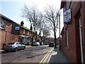
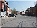
Area Overview for L34 3LJ
Photos of L34 3LJ


Area Information
Living in L34 3LJ means being part of a small, densely populated residential cluster in England. The area covers 872 square metres and is home to 2,666 people, with a population density of 1,962 people per square kilometre. This compact postcode area is characterised by its mix of housing stock and proximity to local amenities. The community here is predominantly composed of adults aged 30–64, with a median age of 47, suggesting a stable, established population. Daily life is shaped by the area’s proximity to retail hubs, rail networks, and schools. While the postcode is small, it offers a blend of practical living with access to essential services. For buyers, the area’s size means a tight-knit community, where homes are largely owner-occupied and the housing stock is focused on traditional properties. The absence of major environmental constraints, such as protected woodlands or AONBs, allows for straightforward planning and development. However, the area’s compact nature means that residents must balance convenience with the limitations of a small footprint.
- Area Type
- Postcode
- Area Size
- 872 m²
- Population
- 2666
- Population Density
- 1962 people/km²
The property market in L34 3LJ is defined by its high home ownership rate of 66% and a focus on houses rather than flats or apartments. This suggests a community where most residents are long-term homeowners, likely contributing to a stable but limited market. The small size of the postcode area means that housing stock is constrained, which could make finding properties competitive. The predominance of houses indicates a preference for single-family homes, which may appeal to families or those seeking more space. However, the compact nature of the area means that buyers must consider proximity to amenities and transport links as critical factors. For those seeking rental properties, the data does not indicate a strong rental market, implying that owner-occupation is the norm. Prospective buyers should be prepared for a limited selection of properties, with a focus on existing homes rather than new developments.
House Prices in L34 3LJ
No properties found in this postcode.
Energy Efficiency in L34 3LJ
The lifestyle in L34 3LJ is shaped by its proximity to retail and rail amenities. Nearby shops include Heron Eccleston, Tesco Prescot, and M&S Prescot, offering a range of shopping options from everyday essentials to more specialised services. These retail outlets cater to both practical needs and leisure, supporting a convenient daily routine. The area’s rail network, with stations such as Prescot and Whiston, provides easy access to commuting routes, reducing the need for long car journeys. While the data does not mention parks or leisure facilities, the absence of environmental constraints like protected woodlands or AONBs suggests that local green spaces may be limited. Nonetheless, the combination of retail, rail, and a compact layout ensures that residents can access most necessities without significant travel. This makes L34 3LJ appealing for those who prioritise convenience and proximity to services.
Amenities
Schools
Residents of L34 3LJ have access to three schools within practical reach. Two are primary schools named Prescot School and The Prescot School, both offering primary education. A third school, also named The Prescot School, operates as an academy with an Ofsted rating of satisfactory. This mix of school types provides families with options, though the academy’s rating suggests it meets minimum standards but may not excel in areas like performance or facilities. The presence of multiple primary schools indicates a focus on early education, which is crucial for families with young children. However, the data does not include secondary schools or further education institutions, meaning parents may need to look beyond the immediate area for comprehensive schooling. The availability of local primary education is a key consideration for buyers prioritising convenience.
| Rank | School | Type | Entry gender | Ages |
|---|
Explore more schools in this area
Go to Schools tabDemographics
The community in L34 3LJ is predominantly composed of adults aged 30–64, with a median age of 47. This suggests a mature population, likely with established careers and families. Home ownership is high, at 66%, indicating a stable housing market where most residents are long-term occupants rather than renters. The accommodation type is primarily houses, which contrasts with areas dominated by flats or apartments. The predominant ethnic group is White, reflecting a homogenous demographic profile. While the data does not provide specific figures on deprivation, the high home ownership rate and age distribution suggest a community with relatively stable economic conditions. The absence of detailed diversity statistics means the area’s social composition is not fully quantified, but the figures available paint a picture of a settled, middle-aged population with a focus on traditional housing.
Household Size
Accommodation Type
Tenure
Ethnic Group
Religion
Household Composition
Age
Household Deprivation
NS-SEC
Explore more demographic insights in this area
Go to Demographics tabPlanning
Planning Constraints
- Flood RiskPremium
- Ramsar Wetland SitesPremium
- Area of Outstanding Natural BeautyPremium
- Protected Nature ReservePremium
- Protected WoodlandPremium