Area Overview for L34 1NL
Photos of L34 1NL
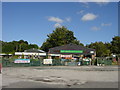
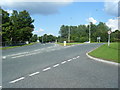
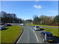
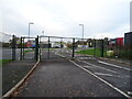


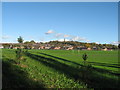
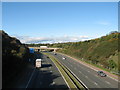
17 photos from this area
Area Information
Key information about the L34 1NL including its size, population, and administrative classification.
- Area Type
- Postcode
- Area Size
- 5.0 hectares
- Population
- 2666
- Population Density
- 1962 people/km²
House Prices in L34 1NL
13
Properties
£172,200
Average Sold Price
£74,950
Lowest Price
£230,000
Highest Price
Showing 13 properties
| Address | Type | Beds | Baths | Last Sale Price | Last Sale Date | |
|---|---|---|---|---|---|---|
| 37 Liverpool Road, Prescot, L34 1NL | Bungalow | - | - | £230,000 | Oct 2022 | |
| 47 Liverpool Road, Prescot, L34 1NL | Bungalow | - | - | £218,000 | Apr 2021 | |
| 35 Liverpool Road, Prescot, L34 1NL | Bungalow | 2 | 1 | £200,000 | Jan 2021 | |
| 49 Liverpool Road, Prescot, L34 1NL | Semi-detached | 2 | 1 | £135,000 | Jul 2012 | |
| 41 Liverpool Road, Prescot, L34 1NL | Semi-detached | - | - | £189,950 | May 2005 | |
| 39 Liverpool Road, Prescot, L34 1NL | Semi-detached | - | - | £157,500 | Sep 2004 | |
| 43 Liverpool Road, Prescot, L34 1NL | Semi-detached | 2 | 1 | £74,950 | Sep 2001 | |
| 2, Brookbridge Cottages, Liverpool Road, Prescot, L34 1NL | Detached | - | - | - | - | |
| 1, Brookbridge Cottages, Liverpool Road, Prescot, L34 1NL | Detached | - | - | - | - | |
| 45 Liverpool Road, Prescot, L34 1NL | Semi-detached | - | - | - | - |
Page 1 of 2
Energy Efficiency in L34 1NL
Amenities
Schools
| Rank | School | Type | Entry gender | Ages |
|---|
Explore more schools in this area
Go to Schools tabDemographics
Household Size
Two person
most common
Accommodation Type
Houses
most common
Tenure
66
majority
Ethnic Group
White
most common
Religion
N/A
most common
Household Composition
N/A
most common
Age
47
median
Adults (30-64 years)
most common
Household Deprivation
N/A
with no deprivation
NS-SEC
36
in Lower managerial occupations
Explore more demographic insights in this area
Go to Demographics tabPlanning
Planning Constraints
- Flood RiskPremium
- Ramsar Wetland SitesPremium
- Area of Outstanding Natural BeautyPremium
- Protected Nature ReservePremium
- Protected WoodlandPremium