Area Overview for L34 0EW
Photos of L34 0EW
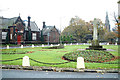
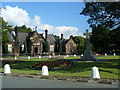
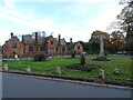
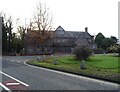
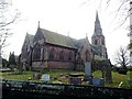
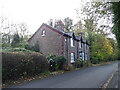
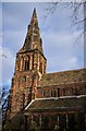
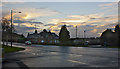
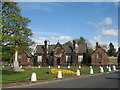
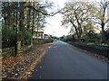
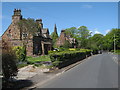
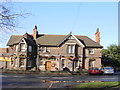
13 photos from this area
Area Information
Key information about the L34 0EW including its size, population, and administrative classification.
- Area Type
- Postcode
- Area Size
- 8882 m²
- Population
- 1150
- Population Density
- 552 people/km²
House Prices in L34 0EW
12
Properties
£253,750
Average Sold Price
£60,000
Lowest Price
£455,000
Highest Price
Showing 12 properties
| Address | Type | Beds | Baths | Last Sale Price | Last Sale Date | |
|---|---|---|---|---|---|---|
| 157 Sugar Lane, Knowsley, L34 0EW | house | - | - | £455,000 | Oct 2020 | |
| Elm Tree House, Sugar Lane, Knowsley, L34 0EW | house | - | - | £250,000 | Sep 2020 | |
| Yew Tree House, Sugar Lane, Knowsley, L34 0EW | house | - | - | £250,000 | Sep 2020 | |
| 43 Sugar Lane, Knowsley, L34 0EW | Semi-detached | - | - | £60,000 | Jul 2013 | |
| 47 Sugar Lane, Knowsley, L34 0EW | house | - | - | - | - | |
| 41 Sugar Lane, Knowsley, L34 0EW | Semi-detached | - | - | - | - | |
| 167 Sugar Lane, Knowsley, L34 0EW | house | - | - | - | - | |
| 49 Sugar Lane, Knowsley, L34 0EW | Terraced | - | - | - | - | |
| Fir Tree House, Sugar Lane, Knowsley, L34 0EW | house | - | - | - | - | |
| Beech Tree House, Sugar Lane, Knowsley, L34 0EW | house | - | - | - | - |
Page 1 of 2
Energy Efficiency in L34 0EW
Amenities
Schools
| Rank | School | Type | Entry gender | Ages |
|---|
Explore more schools in this area
Go to Schools tabDemographics
Household Size
Two person
most common
Accommodation Type
Houses
most common
Tenure
80
majority
Ethnic Group
White
most common
Religion
N/A
most common
Household Composition
N/A
most common
Age
47
median
Adults (30-64 years)
most common
Household Deprivation
N/A
with no deprivation
NS-SEC
32
in Lower managerial occupations
Explore more demographic insights in this area
Go to Demographics tabPlanning
Planning Constraints
- Flood RiskPremium
- Ramsar Wetland SitesPremium
- Area of Outstanding Natural BeautyPremium
- Protected Nature ReservePremium
- Protected WoodlandPremium