Area Overview for L33 7YW
Photos of L33 7YW


Area Information
Living in L33 7YW means being part of a small, tightly knit residential cluster in England. With a population of 1,451 spread across 235 people per square kilometre, this area is compact yet functional. It caters to a mature demographic, with the median age at 47 and the majority of residents falling between 30 and 64 years old. The area is defined by its housing stock, with homes predominating over other property types. While it lacks the density of larger urban centres, its proximity to rail networks and retail hubs offers practical connectivity. Daily life here balances quiet residential living with access to nearby amenities, making it suitable for those prioritising convenience without the bustle of a major city. The postcode’s small size means it is not a high-traffic area, but its placement near key transport links ensures it is not isolated. For those seeking a community with a focus on stability and accessibility, L33 7YW provides a straightforward, no-frills environment.
- Area Type
- Postcode
- Area Size
- Not available
- Population
- 1451
- Population Density
- 235 people/km²
The property market in L33 7YW is characterised by a 50% home ownership rate, suggesting a balanced split between owner-occupied and rental properties. The area’s accommodation type is predominantly houses, which means it lacks the high-rise or apartment blocks common in denser urban areas. This makes it a more traditional, low-rise neighbourhood, likely appealing to those seeking private, standalone homes. Given the small size of the postcode, the housing stock is limited, which could mean fewer options for buyers. However, the presence of nearby rail stations and retail amenities suggests that the area is positioned to attract commuters or those prioritising convenience over expansive living spaces. For buyers, this means a focus on individual homes rather than shared or rental units, with the potential for long-term value if the area’s stability persists.
House Prices in L33 7YW
No properties found in this postcode.
Energy Efficiency in L33 7YW
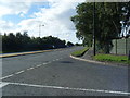
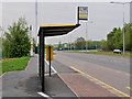
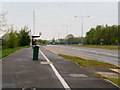
Residents of L33 7YW have access to a range of nearby amenities that support daily life. Retail options include Spar, Makro Liverpool, and Spar Coopers, offering convenience for grocery shopping and essential purchases. The area’s proximity to five rail stations—Headbolt Lane, Kirkby, and Fazakerley—ensures easy access to public transport, which is vital for commuting or exploring further afield. While the area itself is small, its placement near these stations and retail hubs means it is well-served for practical needs. The absence of major leisure or recreational facilities within the postcode suggests that residents may rely on nearby towns for dining, entertainment, or outdoor activities. However, the availability of multiple retail outlets and rail links provides a baseline of convenience, making it easier to manage household tasks without long journeys.
Amenities
Schools
| Rank | School | Type | Entry gender | Ages |
|---|
Explore more schools in this area
Go to Schools tabDemographics
The community in L33 7YW is predominantly composed of adults aged 30 to 64, reflecting a mature population with a median age of 47. Home ownership here stands at 50%, indicating a mix of owner-occupied and rental properties. The area is largely homogenous, with the White ethnic group forming the majority. This demographic profile suggests a population that is likely established in their careers and focused on long-term stability. The absence of specific data on deprivation means it is unclear how this affects quality of life, but the age range implies a community with a strong presence of working-age adults. With no significant younger or older populations noted, L33 7YW appears to cater to those in midlife, possibly with families or those seeking a quieter lifestyle. The housing stock, centred on individual homes, aligns with this demographic’s preference for private, settled living.
Household Size
Accommodation Type
Tenure
Ethnic Group
Religion
Household Composition
Age
Household Deprivation
NS-SEC
Explore more demographic insights in this area
Go to Demographics tabPlanning
Planning Constraints
- Flood RiskPremium
- Ramsar Wetland SitesPremium
- Area of Outstanding Natural BeautyPremium
- Protected Nature ReservePremium
- Protected WoodlandPremium