Area Overview for L33 6XF
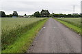
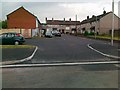
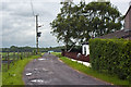
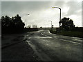
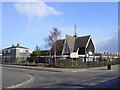
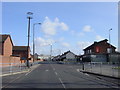
Photos of L33 6XF


Area Information
Living in L33 6XF means being part of a tightly knit residential cluster in England, where 2,163 people reside in a space that supports a population density of 1,602 people per square kilometre. This postcode area is small but functional, offering a balance of private living and community proximity. Daily life here is shaped by its compact nature, with amenities and services within practical reach. The area’s character is defined by its focus on housing, with most properties being homes rather than flats or apartments. While it is not a sprawling suburb, the density suggests a mix of established residents and those seeking a quieter, more manageable environment. The age profile of the population, skewed toward adults aged 30–64, hints at a community that is neither dominated by young families nor retirees, but rather a stable demographic with a median age of 47. For those considering L33 6XF, it is a place where convenience and simplicity of living are prioritised, though the small scale means it is best suited for those who value proximity to essential services over expansive space.
- Area Type
- Postcode
- Area Size
- Not available
- Population
- 2163
- Population Density
- 1602 people/km²
The property market in L33 6XF is characterised by a low home ownership rate of 33%, suggesting that a significant portion of the housing stock is rented out or occupied by tenants. The predominant accommodation type is houses, which means the area is not dominated by high-density developments or apartment blocks. This mix may appeal to buyers seeking single-family homes in a compact setting, though the small size of the postcode area implies limited options for expansion or new builds. The low home ownership percentage also indicates that the market is more likely to be influenced by rental demand than by long-term property investment. For those considering purchasing in L33 6XF, the focus on houses means that properties are likely to be larger in scale compared to areas with a higher proportion of flats. However, the small geographic footprint of the area means that buyers must be selective, as the immediate surroundings offer limited additional options.
House Prices in L33 6XF
No properties found in this postcode.
Energy Efficiency in L33 6XF
The lifestyle in L33 6XF is shaped by its proximity to essential amenities, including five railway stations and a selection of retail outlets. The nearby rail network, with stops such as Headbolt Lane and Kirkby, provides access to broader regional connections, making commuting feasible for those working outside the area. Retail options include Morrisons Kirkby, Farmfoods Northwood, and Iceland Kirkby, offering a range of grocery and household services. While the data does not mention parks or leisure facilities, the presence of these retail and transport hubs suggests a focus on practicality over expansive recreational spaces. The area’s small size means that daily life is centred around these nearby venues, creating a self-contained environment where convenience is prioritised. For residents, this translates to a lifestyle that balances accessibility with the limitations of a compact postcode.
Amenities
Schools
The nearest school to L33 6XF is St Marie’s Catholic Primary School, a primary institution with an Ofsted rating of ‘good’. This school is the only named educational facility listed in the data, indicating that the area’s school options are limited to primary education. The absence of secondary schools or other educational institutions within the immediate vicinity means that families with children may need to look beyond L33 6XF for comprehensive schooling. However, the ‘good’ rating for St Marie’s suggests that the primary education available is of a standard that meets regulatory benchmarks. For parents prioritising proximity to schools, this single option may necessitate a broader search, though the quality of the existing school is a positive factor. The lack of additional schools also highlights a potential limitation for families requiring a range of educational choices.
| Rank | School | Type | Entry gender | Ages |
|---|
Explore more schools in this area
Go to Schools tabDemographics
The community in L33 6XF is predominantly composed of adults aged 30–64, with a median age of 47. This suggests a mature, established population with a strong presence of working-age individuals. Home ownership here is relatively low, with only 33% of residents owning their homes, indicating a higher reliance on rental properties or other forms of tenure. The accommodation type is primarily houses, which contrasts with areas where flats or apartments dominate. The predominant ethnic group is White, though no further breakdown of diversity is provided. The data does not include specific figures on deprivation, but the combination of low home ownership and a mature population may suggest a community where economic stability is variable. For prospective buyers, this demographic profile implies a market that is not driven by young families but rather by individuals or couples seeking a settled, low-maintenance lifestyle.
Household Size
Accommodation Type
Tenure
Ethnic Group
Religion
Household Composition
Age
Household Deprivation
NS-SEC
Explore more demographic insights in this area
Go to Demographics tabPlanning
Planning Constraints
- Flood RiskPremium
- Ramsar Wetland SitesPremium
- Area of Outstanding Natural BeautyPremium
- Protected Nature ReservePremium
- Protected WoodlandPremium