Area Overview for L33 5YW
Photos of L33 5YW


Area Information
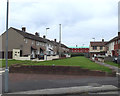
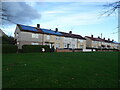
Living in L33 5YW means inhabiting a small, tightly knit residential cluster in England, where the population of 1,455 residents creates a quiet, community-focused environment. This area is characterised by its compact size, which fosters a sense of familiarity among neighbours. Daily life here balances practicality with proximity to essential services, including multiple rail stations and retail outlets. The area’s location near the Liverpool Belfast Ferry Terminal Bootle adds a unique maritime connection, though the primary focus remains on local amenities. With no significant natural or protected sites nearby, the landscape is unremarkable but functional. The demographic profile suggests a mature population, with a median age of 47, and a majority of residents aged between 30 and 64. This suggests a stable, long-term community rather than a transient one. For those seeking a low-key, manageable lifestyle with access to transport and retail, L33 5YW offers a straightforward, no-frills option. However, the high crime risk score of 29/100 indicates that safety considerations must be prioritised.
- Area Type
- Postcode
- Area Size
- Not available
- Population
- 1455
- Population Density
- 6015 people/km²
The property market in L33 5YW is defined by a 37% home ownership rate, indicating that the majority of properties are rented rather than owned. The accommodation type is predominantly houses, which suggests a focus on single-family homes rather than apartments or flats. This configuration may appeal to those seeking space and privacy, though the low home ownership rate implies limited opportunities for long-term investment in property. The small population and compact area suggest a limited housing stock, which could mean competition for available homes. For buyers, this dynamic may present challenges in securing a property, particularly if demand exceeds supply. The absence of high-end or luxury properties is evident, with the market likely catering to practical, budget-conscious buyers. The predominance of houses also means that the area may not be ideal for those prioritising urban density or rental yields.
House Prices in L33 5YW
No properties found in this postcode.
Energy Efficiency in L33 5YW
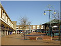
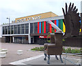
The lifestyle in L33 5YW is shaped by its proximity to retail, rail, and ferry services. Five retail outlets, including Morrisons Kirkby, Farmfoods Northwood, and Iceland Kirkby, provide essential shopping options within reach. These stores cater to daily needs, reducing the necessity for long journeys. The rail network, with stations like Kirkby and Fazakerley, connects residents to wider transport systems, enhancing mobility for work or leisure. The ferry terminal at Liverpool Belfast offers a unique link to maritime travel, though its frequency and utility depend on personal requirements. Parks or green spaces are not explicitly mentioned in the data, which may limit opportunities for outdoor recreation. The overall character of the area leans towards practicality, with amenities focused on functionality rather than luxury. For those valuing convenience and accessibility, L33 5YW offers a straightforward lifestyle with minimal effort required to access daily necessities.
Amenities
Schools
Residents of L33 5YW have access to two primary schools: Simonswood Primary School and Sacred Heart Catholic Primary School. Both institutions cater to younger children, though no Ofsted ratings are provided in the data. The presence of two primary schools within reach suggests a focus on early education, which is crucial for families with young children. However, the absence of secondary schools or further education facilities means that older students may need to travel beyond the immediate area for schooling. The mix of school types—both non-denominational and Catholic—offers some choice in educational philosophy, though the data does not clarify the quality or capacity of these institutions. For families prioritising proximity to schools, L33 5YW’s primary options are a practical advantage, but the lack of secondary provision may be a limitation.
| Rank | School | Type | Entry gender | Ages |
|---|
Explore more schools in this area
Go to Schools tabDemographics
The community in L33 5YW is predominantly composed of adults aged 30 to 64, with a median age of 47. This suggests a mature population, likely with established careers and families. Home ownership stands at 37%, which is notably lower than the national average, indicating a higher proportion of renters. The accommodation type is primarily houses, which may reflect a preference for larger living spaces over flats. The predominant ethnic group is White, with no data provided on other ethnicities. This homogeneity may influence the area’s cultural dynamics and community interactions. The lower home ownership rate could imply a reliance on rental properties, potentially affecting long-term stability for residents. The absence of specific data on deprivation or income levels means the quality of life implications of these demographics remain unquantified. However, the age profile and housing stock suggest a practical, family-oriented environment.
Household Size
Accommodation Type
Tenure
Ethnic Group
Religion
Household Composition
Age
Household Deprivation
NS-SEC
Explore more demographic insights in this area
Go to Demographics tabPlanning
Planning Constraints
- Flood RiskPremium
- Ramsar Wetland SitesPremium
- Area of Outstanding Natural BeautyPremium
- Protected Nature ReservePremium
- Protected WoodlandPremium