Area Overview for L33 0XZ
Photos of L33 0XZ
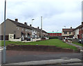

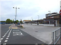
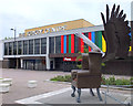
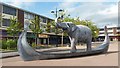
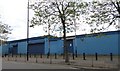

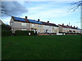
31 photos from this area
Area Information
Key information about the L33 0XZ including its size, population, and administrative classification.
- Area Type
- Postcode
- Area Size
- 6852 m²
- Population
- 1389
- Population Density
- 2536 people/km²
House Prices in L33 0XZ
25
Properties
£82,293
Average Sold Price
£40,000
Lowest Price
£135,000
Highest Price
Showing 25 properties
| Address | Type | Beds | Baths | Last Sale Price | Last Sale Date | |
|---|---|---|---|---|---|---|
| 62 Scoter Road, Northwood, Kirkby, L33 0XZ | Terraced | 4 | 2 | £135,000 | Jul 2025 | |
| 49 Scoter Road, Northwood, Kirkby, L33 0XZ | house | - | - | £100,000 | Jun 2024 | |
| 39 Scoter Road, Northwood, Kirkby, L33 0XZ | Terraced | 3 | 1 | £116,000 | Jan 2023 | |
| 66 Scoter Road, Northwood, Kirkby, L33 0XZ | Terraced | 2 | 1 | £52,000 | Jan 2017 | |
| 41 Scoter Road, Northwood, Kirkby, L33 0XZ | Terraced | - | - | £70,000 | Oct 2007 | |
| 51 Scoter Road, Northwood, Kirkby, L33 0XZ | house | - | - | £63,050 | Jan 2005 | |
| 52 Scoter Road, Northwood, Kirkby, L33 0XZ | Terraced | - | - | £40,000 | Jun 2003 | |
| 25 Scoter Road, Northwood, Kirkby, L33 0XZ | house | - | - | - | - | |
| 37 Scoter Road, Northwood, Kirkby, L33 0XZ | Terraced | - | - | - | - | |
| 47 Scoter Road, Northwood, Kirkby, L33 0XZ | Terraced | - | - | - | - |
Page 1 of 3
Energy Efficiency in L33 0XZ
Amenities
Schools
| Rank | School | Type | Entry gender | Ages |
|---|
Explore more schools in this area
Go to Schools tabDemographics
Household Size
One person
most common
Accommodation Type
Houses
most common
Tenure
38
majority
Ethnic Group
White
most common
Religion
N/A
most common
Household Composition
N/A
most common
Age
47
median
Adults (30-64 years)
most common
Household Deprivation
N/A
with no deprivation
NS-SEC
14
in Lower managerial occupations
Explore more demographic insights in this area
Go to Demographics tabPlanning
Planning Constraints
- Flood RiskPremium
- Ramsar Wetland SitesPremium
- Area of Outstanding Natural BeautyPremium
- Protected Nature ReservePremium
- Protected WoodlandPremium