Area Overview for L32 4TQ
Photos of L32 4TQ
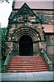
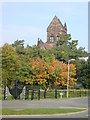
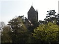
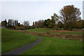
35 photos from this area
Area Information
Key information about the L32 4TQ including its size, population, and administrative classification.
- Area Type
- Postcode
- Area Size
- 7275 m²
- Population
- 1771
- Population Density
- 3539 people/km²
House Prices in L32 4TQ
28
Properties
£63,375
Average Sold Price
£32,000
Lowest Price
£110,000
Highest Price
Showing 28 properties
| Address | Type | Beds | Baths | Last Sale Price | Last Sale Date | |
|---|---|---|---|---|---|---|
| 44 Denver Road, Westvale, Kirkby, L32 4TQ | Terraced | 2 | 1 | £110,000 | Sep 2023 | |
| 20 Denver Road, Westvale, Kirkby, L32 4TQ | Terraced | 3 | 1 | £71,000 | Jun 2019 | |
| 42 Denver Road, Westvale, Kirkby, L32 4TQ | Terraced | 4 | 1 | £77,000 | Mar 2018 | |
| 16 Denver Road, Westvale, Kirkby, L32 4TQ | house | - | - | £65,000 | Aug 2011 | |
| 56 Denver Road, Westvale, Kirkby, L32 4TQ | Terraced | - | - | £75,000 | Sep 2006 | |
| 52 Denver Road, Westvale, Kirkby, L32 4TQ | Terraced | - | - | £79,500 | Jun 2006 | |
| 54 Denver Road, Westvale, Kirkby, L32 4TQ | house | - | - | £55,749 | Jun 2005 | |
| 8 Denver Road, Westvale, Kirkby, L32 4TQ | Flat | 2 | 1 | £35,500 | Mar 2002 | |
| 38 Denver Road, Westvale, Kirkby, L32 4TQ | Terraced | - | - | £33,000 | Aug 2001 | |
| 32 Denver Road, Westvale, Kirkby, L32 4TQ | Terraced | - | - | £32,000 | Sep 1995 |
Page 1 of 3
Energy Efficiency in L32 4TQ
Amenities
Schools
| Rank | School | Type | Entry gender | Ages |
|---|
Explore more schools in this area
Go to Schools tabDemographics
Household Size
Family (3-5 people)
most common
Accommodation Type
Houses
most common
Tenure
42
majority
Ethnic Group
White
most common
Religion
N/A
most common
Household Composition
N/A
most common
Age
47
median
Adults (30-64 years)
most common
Household Deprivation
N/A
with no deprivation
NS-SEC
16
in Lower managerial occupations
Explore more demographic insights in this area
Go to Demographics tabPlanning
Planning Constraints
- Flood RiskPremium
- Ramsar Wetland SitesPremium
- Area of Outstanding Natural BeautyPremium
- Protected Nature ReservePremium
- Protected WoodlandPremium