Area Overview for L3 8PY
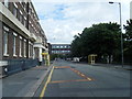
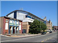
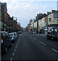
Photos of L3 8PY


Area Information
Living in L3 8PY means inhabiting one of the densest residential clusters in England, where 1,959 people reside within just 3,768 square metres. This compact area, centred around a small postcode, is defined by its proximity to major transport hubs and retail corridors. The community here is young, with a median age of 22 and most residents aged between 15 and 29. Daily life is shaped by the area’s strategic location, with easy access to Liverpool Lime Street railway station and multiple ferry terminals. Flats dominate the housing stock, reflecting a rental-focused market. While the area lacks natural landscapes or protected sites, its vibrancy comes from nearby amenities. Residents can walk to supermarkets like Tesco Liverpool and Lidl Central, or catch a train to central Liverpool within minutes. The high population density means the area feels lively but also tightly packed, ideal for those seeking convenience over space. For buyers, L3 8PY offers a snapshot of urban living at its most efficient, though its small size means housing choices are limited to a handful of flats.
- Area Type
- Postcode
- Area Size
- 3768 m²
- Population
- 1959
- Population Density
- 7716 people/km²
The property market in L3 8PY is almost entirely rental-based, with just 5% of homes owned by residents. This statistic underscores a community where long-term residency is rare, and flats are the sole accommodation type available. The small area size and high population density mean housing stock is limited to a handful of units, all of which are likely to be occupied by tenants. For buyers, this presents a challenge: the area is not a traditional homeownership market but a niche for investors or those seeking short-term lets. The flat-dominated landscape suggests properties are likely to be smaller, with minimal private outdoor space. Given the area’s proximity to transport links and retail, it may appeal to those prioritising convenience over space. However, the lack of natural constraints or planning restrictions means there is little scope for development, limiting future property value growth. Buyers should approach this market with realistic expectations, focusing on rental yield rather than capital appreciation.
House Prices in L3 8PY
Showing 1 properties
| Address | Type | Beds | Baths | Last Sale Price | Last Sale Date | |
|---|---|---|---|---|---|---|
| Liverpool John Moores University, 24 Norton Street, Liverpool, L3 8PY | university_college | - | - | - | - |
Energy Efficiency in L3 8PY
Residents of L3 8PY enjoy a lifestyle defined by accessibility and proximity to urban amenities. Within walking distance are retail outlets like Tesco Liverpool, Lidl Central, and M&S Liverpool Lime St Rail SF, offering daily essentials and convenience shopping. The area’s rail network, including Liverpool Lime Street and Moorfields stations, provides seamless connections to the city’s business districts, universities, and cultural hubs. Ferry terminals nearby, such as Liverpool Pier Head and Seacombe, open up travel options to the Isle of Man, Dublin, and other coastal destinations. While the area lacks parks or green spaces, its compact footprint ensures residents are never far from dining, shopping, or transport. The presence of multiple rail lines and ferry services also means the area is ideal for commuters or those seeking a base for short-term stays. The lifestyle here is fast-paced, with a focus on efficiency, though the lack of natural amenities may appeal more to those prioritising connectivity over leisure.
Amenities
Schools
| Rank | School | Type | Entry gender | Ages |
|---|
Explore more schools in this area
Go to Schools tabDemographics
The population of L3 8PY is overwhelmingly young, with a median age of 22 and 85% of residents falling within the 15–29 age range. This demographic skew suggests a transient community, with few long-term residents. Home ownership is exceptionally low at 5%, indicating that nearly all housing is rented. The accommodation type is exclusively flats, a reflection of the area’s compact footprint. The predominant ethnic group is White, though specific diversity metrics are not provided. The high population density of 519,971 people per square kilometre means shared spaces and communal living are the norm. This density can impact quality of life, with limited private outdoor space and potential strain on local services. However, it also fosters a tightly knit environment, where proximity to amenities and transport is a daily advantage. For buyers, the demographic profile suggests a market geared toward short-term rental or investment, rather than family-oriented homeownership.
Household Size
Accommodation Type
Tenure
Ethnic Group
Religion
Household Composition
Age
Household Deprivation
NS-SEC
Explore more demographic insights in this area
Go to Demographics tabPlanning
Planning Constraints
- Flood RiskPremium
- Ramsar Wetland SitesPremium
- Area of Outstanding Natural BeautyPremium
- Protected Nature ReservePremium
- Protected WoodlandPremium