Area Overview for L3 6LL
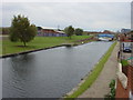
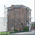
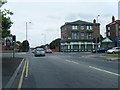
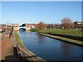
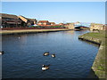
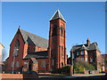
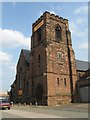
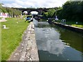
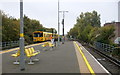
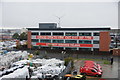
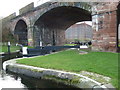
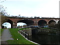
Photos of L3 6LL
Area Information
Living in L3 6LL means inhabiting a compact residential cluster in England’s north-west, where 1,840 people reside across 1.3 hectares. The area’s population density of 843 people per square kilometre reflects a tightly knit community, with homes predominantly occupied by adults aged 30–64. Daily life here is shaped by proximity to essential services and transport links. Residents benefit from nearby rail stations, ferry terminals, and retail hubs, while the area’s low flood risk and absence of protected natural sites suggest a practical, unencumbered living environment. The presence of two primary schools, Our Lady of Reconciliation Catholic Primary School and its infant counterpart, underscores a family-oriented character. Though small, L3 6LL offers a balance of accessibility and residential tranquillity, with homes primarily in single-family units. For buyers, the area’s compact size means a focused search, but its amenities and connectivity make it a viable choice for those prioritising convenience over expansive space.
- Area Type
- Postcode
- Area Size
- 1.3 hectares
- Population
- 1840
- Population Density
- 843 people/km²
The property market in L3 6LL is characterised by a 30% home ownership rate, indicating that most properties are likely rented rather than owner-occupied. The accommodation type is predominantly houses, which suggests a focus on single-family homes rather than apartments or flats. This housing stock may appeal to buyers seeking traditional, spacious living arrangements, though the area’s small size means the available properties are limited. The low home ownership rate could signal a rental market dominated by landlords or private tenants, which may affect property values and investment potential. For buyers, the compact nature of L3 6LL means competition for available homes, but the proximity to amenities and transport links could offset this constraint. The absence of planning constraints or protected sites may also make the area more attractive for those prioritising practicality over environmental restrictions.
House Prices in L3 6LL
Showing 50 properties
| Address | Type | Beds | Baths | Last Sale Price | Last Sale Date | |
|---|---|---|---|---|---|---|
| 25 Colin Drive, Liverpool, L3 6LL | Semi-detached | 3 | 1 | £192,500 | Aug 2024 | |
| 62 Colin Drive, Liverpool, L3 6LL | Semi-detached | 3 | 1 | £77,500 | Jul 2023 | |
| 30 Colin Drive, Liverpool, L3 6LL | Terraced | 2 | 1 | £155,000 | Jun 2023 | |
| 43 Colin Drive, Liverpool, L3 6LL | Semi-detached | 3 | 1 | £180,000 | Mar 2023 | |
| 33 Colin Drive, Liverpool, L3 6LL | house | - | - | £66,250 | Nov 2021 | |
| 46 Colin Drive, Liverpool, L3 6LL | Terraced | 2 | 1 | £112,500 | Aug 2019 | |
| 3 Colin Drive, Liverpool, L3 6LL | Terraced | 2 | 1 | £117,500 | Jul 2019 | |
| 18 Colin Drive, Liverpool, L3 6LL | house | 2 | 1 | £110,000 | Dec 2017 | |
| 40 Colin Drive, Liverpool, L3 6LL | Semi-detached | 3 | 1 | £122,000 | Jun 2017 | |
| 54 Colin Drive, Liverpool, L3 6LL | Terraced | 3 | - | £118,000 | May 2014 |
Energy Efficiency in L3 6LL
The lifestyle in L3 6LL is shaped by its proximity to retail, dining, and transport hubs. Within reach are five retail outlets, including Costco Liverpool, Sainsburys Liverpool Great, and Spar, offering a range of shopping options. The area’s rail and ferry connections provide easy access to broader regional networks, facilitating both daily commutes and weekend excursions. While specific parks or leisure facilities are not listed in the data, the presence of multiple transport links suggests opportunities for outdoor activities beyond the immediate vicinity. The compact nature of the area means amenities are concentrated, reducing travel time for essentials. Residents can enjoy a mix of local services and broader connectivity, though the absence of named leisure venues or dining options leaves some aspects of the lifestyle unquantified. The focus on practicality and accessibility makes L3 6LL suitable for those prioritising convenience over expansive recreational spaces.
Amenities
Schools
Residents of L3 6LL have access to two primary schools: Our Lady of Reconciliation Catholic Primary School and Our Lady of Reconciliation RC Infant School. Both institutions cater to younger children, providing a dedicated educational environment for families with young dependents. The presence of two primary schools within the area suggests a focus on early education, though no secondary schools are listed in the data. This mix of school types may be beneficial for parents seeking a seamless transition between infant and primary education. However, the lack of secondary school options could necessitate travel for older students. Families prioritising Catholic schooling may find these institutions particularly suitable, but those requiring a broader range of educational choices may need to look beyond L3 6LL. The schools’ proximity to homes underscores the area’s family-friendly orientation.
| Rank | School | Type | Entry gender | Ages |
|---|
Explore more schools in this area
Go to Schools tabDemographics
The community in L3 6LL is predominantly composed of adults aged 30–64, with a median age of 47. Home ownership here is relatively low at 30%, suggesting a higher proportion of rental properties. The accommodation type is largely houses, reflecting a traditional housing stock. The predominant ethnic group is White, though specific data on diversity is not provided. The population density of 843 people per square kilometre indicates a moderately crowded environment, which may influence the character of local interactions and community dynamics. For residents, this density could mean a mix of established families and individuals seeking proximity to services. The age profile suggests a stable, mature demographic, potentially with a focus on long-term residency over transient populations. However, the lack of detailed deprivation data means the area’s socioeconomic challenges remain unquantified in this analysis.
Household Size
Accommodation Type
Tenure
Ethnic Group
Religion
Household Composition
Age
Household Deprivation
NS-SEC
Explore more demographic insights in this area
Go to Demographics tabPlanning
Planning Constraints
- Flood RiskPremium
- Ramsar Wetland SitesPremium
- Area of Outstanding Natural BeautyPremium
- Protected Nature ReservePremium
- Protected WoodlandPremium