Area Overview for L3 6LH
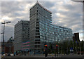
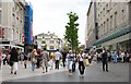
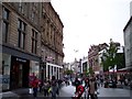
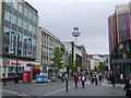
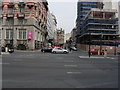
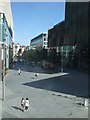
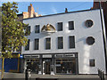
Photos of L3 6LH


Area Information
Living in L3 6LH means inhabiting a tightly packed residential cluster in England, where 2,036 people reside across just 9,811 square metres. This results in a population density of 207,524 people per square kilometre, reflecting a compact, densely populated environment. The area is defined by its proximity to key transport hubs, including multiple railway stations and ferry terminals, which connect residents to Liverpool’s broader network. Daily life here is shaped by the presence of retail outlets like Tesco Liverpool and Sainsburys Nations, alongside the vibrancy of nearby transport infrastructure. The area’s small size means amenities are within practical reach, though its high density may influence the pace of life. With a median age of 22, the community is young, dominated by individuals aged 15–29, suggesting a dynamic, possibly student or transient population. This makes L3 6LH a location where convenience and connectivity are prioritised over expansive living spaces.
- Area Type
- Postcode
- Area Size
- 9811 m²
- Population
- 2036
- Population Density
- 6343 people/km²
The property market in L3 6LH is characterised by a low rate of home ownership, with only 22% of residents owning their homes. This suggests a rental market that dominates the area, likely driven by the high population density and the prevalence of flats as the primary accommodation type. The compact size of the postcode means property options are limited to smaller units, typically within multi-occupancy buildings. For buyers, this implies a focus on rental properties rather than owner-occupied homes, with limited scope for long-term investment in private residences. The concentration of flats may also indicate a demand for affordable, short-term housing, possibly catering to students or temporary residents. Given the area’s size, buyers should consider nearby neighbourhoods for more diverse property choices.
House Prices in L3 6LH
Showing 51 properties
| Address | Type | Beds | Baths | Last Sale Price | Last Sale Date | |
|---|---|---|---|---|---|---|
| 96 Princes Gardens, Liverpool, L3 6LH | Flat | 2 | 1 | £120,000 | Oct 2025 | |
| 73 Princes Gardens, Liverpool, L3 6LH | Flat | 2 | 1 | £132,500 | Oct 2024 | |
| 51 Princes Gardens, Liverpool, L3 6LH | Flat | 3 | 1 | £142,500 | Sep 2024 | |
| 89 Princes Gardens, Liverpool, L3 6LH | Flat | - | - | £110,000 | Feb 2024 | |
| 76 Princes Gardens, Liverpool, L3 6LH | Flat | - | - | £116,000 | Dec 2022 | |
| 50 Princes Gardens, Liverpool, L3 6LH | Flat | - | - | £120,000 | Dec 2022 | |
| 56 Princes Gardens, Liverpool, L3 6LH | Flat | 2 | 1 | £117,500 | Apr 2022 | |
| 70 Princes Gardens, Liverpool, L3 6LH | Flat | 3 | 1 | £110,000 | Dec 2021 | |
| 86 Princes Gardens, Liverpool, L3 6LH | Flat | - | - | £102,500 | Mar 2021 | |
| 97 Princes Gardens, Liverpool, L3 6LH | Flat | 2 | 1 | £110,000 | Mar 2021 |
Energy Efficiency in L3 6LH
Residents of L3 6LH have access to a range of nearby amenities, including retail outlets like Tesco Liverpool and Sainsburys Nations, which provide essential shopping options. The area’s proximity to rail stations such as Moorfields and Liverpool Lime Street Low Level ensures easy access to urban centres, while ferry terminals like Liverpool Pier Head and Seacombe connect to maritime routes. These transport links, combined with retail availability, create a lifestyle that prioritises convenience and mobility. The compact nature of the area means amenities are within walking or short transit distance, reducing the need for long commutes. While the variety of retail and transport options is notable, the absence of specific parks or leisure facilities suggests a focus on urban connectivity over recreational spaces.
Amenities
Schools
| Rank | School | Type | Entry gender | Ages |
|---|
Explore more schools in this area
Go to Schools tabDemographics
The community in L3 6LH is overwhelmingly young, with a median age of 22 and 83% of residents falling within the 15–29 age range. This demographic profile suggests a population skewed towards students, young professionals, or those in early careers. Home ownership is low, with just 22% of households owning their homes, indicating a rental-dominated market. The accommodation type is predominantly flats, reflecting the area’s compact nature and limited space for larger properties. The predominant ethnic group is White, though specific data on diversity or deprivation is not provided. The high proportion of young adults may influence local dynamics, such as demand for short-term rentals or student housing. The combination of high population density and limited home ownership points to a community shaped by transient needs and shared living arrangements.
Household Size
Accommodation Type
Tenure
Ethnic Group
Religion
Household Composition
Age
Household Deprivation
NS-SEC
Explore more demographic insights in this area
Go to Demographics tabPlanning
Planning Constraints
- Flood RiskPremium
- Ramsar Wetland SitesPremium
- Area of Outstanding Natural BeautyPremium
- Protected Nature ReservePremium
- Protected WoodlandPremium