Area Overview for L3 6JY
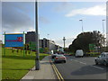
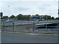
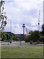
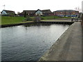
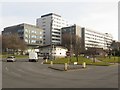
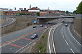
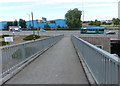
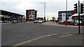
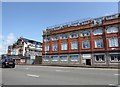
Photos of L3 6JY


Area Information
Living in L3 6JY means being part of a compact residential cluster in England, where 1,840 people reside across 9,225 square metres. The area’s population density of 843 people per square kilometre suggests a tightly knit community, with homes primarily occupied by adults aged 30–64. This postcode is characterised by its proximity to essential services and transport links, making it practical for daily life. Residents benefit from nearby schools, retail outlets, and multiple rail and ferry connections. While the area lacks natural conservation designations, its accessibility to Liverpool’s urban infrastructure ensures convenience. For those seeking a balance between residential tranquillity and urban connectivity, L3 6JY offers a small but functional footprint. The presence of two primary schools and a range of retail options within walking distance further supports a family-oriented lifestyle. However, the area’s compact size means that amenities are concentrated, requiring careful consideration of commuting needs for those working beyond the immediate vicinity.
- Area Type
- Postcode
- Area Size
- 9225 m²
- Population
- 1840
- Population Density
- 843 people/km²
The property market in L3 6JY is shaped by its low home ownership rate of 30%, suggesting a rental-dominated landscape. The area’s accommodation type is predominantly houses, which may appeal to families seeking space but could limit availability for first-time buyers. This small postcode’s compact size means property choices are limited, with homes likely concentrated in a few clusters. For buyers, this could mean higher competition for available properties and a focus on proximity to essential services. The rental market’s prevalence might also influence property prices, with potential for growth if demand increases. However, the area’s small size means that buyers must consider nearby neighbourhoods for a broader selection. The mix of houses and limited ownership suggests a community where long-term residents may outnumber new arrivals, creating a stable but potentially niche market.
House Prices in L3 6JY
Showing 26 properties
| Address | Type | Beds | Baths | Last Sale Price | Last Sale Date | |
|---|---|---|---|---|---|---|
| 58 Eldonian Way, Liverpool, L3 6JY | Semi-detached | - | - | - | - | |
| 100 Eldonian Way, Liverpool, L3 6JY | Bungalow | - | - | - | - | |
| 78 Eldonian Way, Liverpool, L3 6JY | house | - | - | - | - | |
| 64 Eldonian Way, Liverpool, L3 6JY | house | - | - | - | - | |
| 72 Eldonian Way, Liverpool, L3 6JY | house | - | - | - | - | |
| 88 Eldonian Way, Liverpool, L3 6JY | Bungalow | - | - | - | - | |
| 96 Eldonian Way, Liverpool, L3 6JY | Bungalow | - | - | - | - | |
| 94 Eldonian Way, Liverpool, L3 6JY | house | - | - | - | - | |
| 54 Eldonian Way, Liverpool, L3 6JY | house | - | - | - | - | |
| 60 Eldonian Way, Liverpool, L3 6JY | house | - | - | - | - |
Energy Efficiency in L3 6JY
Daily life in L3 6JY is enriched by its proximity to a range of amenities. Retail options include Costco Liverpool, Spar, and Co-op, offering everything from groceries to household goods. The area’s rail network, with stations like Sandhills and Moorfields, connects residents to Liverpool’s broader transport system, while ferry terminals provide access to the Isle of Man and Dublin. For leisure, the absence of dedicated parks or recreational facilities means residents may rely on nearby green spaces in the surrounding area. The compact layout ensures that essential services are within walking or short driving distance, fostering convenience. The presence of two primary schools and multiple transport links underscores the area’s appeal to families seeking a balance between urban access and residential comfort.
Amenities
Schools
Residents of L3 6JY have access to two primary schools: Our Lady of Reconciliation Catholic Primary School and Our Lady of Reconciliation RC Infant School. Both institutions serve the local community, offering education for younger children. The presence of two primary schools within the area ensures that families have options for early education, though the lack of secondary schools nearby may require commuting. The Catholic designation of one school indicates a specific religious affiliation, which could be a consideration for families seeking particular educational philosophies. With no data on Ofsted ratings, the quality of education remains unassessed, but the proximity of these schools to homes suggests they are a key factor in the area’s appeal to families.
| Rank | School | Type | Entry gender | Ages |
|---|
Explore more schools in this area
Go to Schools tabDemographics
The community in L3 6JY is predominantly composed of adults aged 30–64, with a median age of 47. This suggests a mature population, likely with established careers and family commitments. Home ownership here is relatively low, with only 30% of residents owning their homes, indicating a rental market that may influence property values and availability. The accommodation type is primarily houses, reflecting a preference for single-family homes over flats. The predominant ethnic group is White, which aligns with broader demographic trends in the region. With a population density of 843 people per square kilometre, the area is moderately populated, fostering a mix of social interaction and personal space. The absence of specific data on deprivation means that quality of life factors such as access to services and safety must be inferred from other metrics, like crime risk and connectivity.
Household Size
Accommodation Type
Tenure
Ethnic Group
Religion
Household Composition
Age
Household Deprivation
NS-SEC
Explore more demographic insights in this area
Go to Demographics tabPlanning
Planning Constraints
- Flood RiskPremium
- Ramsar Wetland SitesPremium
- Area of Outstanding Natural BeautyPremium
- Protected Nature ReservePremium
- Protected WoodlandPremium