Area Overview for L3 3EA
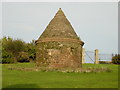
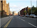
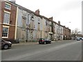
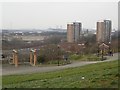
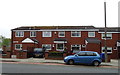
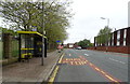
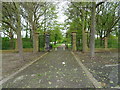
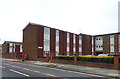
Photos of L3 3EA


Area Information
Living in L3 3EA offers a compact, densely populated residential experience within a small cluster of 963 square metres. With a population of 2,379 people, the area is characterised by a high population density of 2.47 million per square kilometre, reflecting a tightly knit community. This postcode area is not a sprawling suburb but a focused residential hub, likely centred around local amenities and transport links. The demographic profile suggests a mature population, with a median age of 47 and a strong presence of adults aged 30–64. Daily life here is likely shaped by proximity to essential services, with residents relying on nearby shops, transport networks, and schools. The area’s small size means it is probably integrated with surrounding districts, offering access to broader urban infrastructure while maintaining a distinct local identity. For buyers, this compactness could mean a sense of community, though the high density may also influence property availability and living conditions. The mix of housing types and ownership levels adds to the area’s character, balancing private homes with rental options.
- Area Type
- Postcode
- Area Size
- 963 m²
- Population
- 2379
- Population Density
- 3580 people/km²
The property market in L3 3EA is shaped by a low home ownership rate of 23%, indicating that most properties are rented rather than owned. This suggests a rental-dominated market, which may influence property availability and competition for buyers. The accommodation type is primarily houses, which is unusual for a densely populated area and may reflect a focus on family-oriented housing. This mix of rental properties and houses could mean that the area appeals to tenants seeking larger living spaces, while buyers might find limited opportunities for owner-occupation. The small size of the postcode area means that the housing stock is likely concentrated, with limited scope for expansion. Prospective buyers should consider the local rental dynamics and whether the area’s characteristics align with their long-term housing needs.
House Prices in L3 3EA
No properties found in this postcode.
Energy Efficiency in L3 3EA
Residents of L3 3EA benefit from a range of nearby amenities, including five retail outlets such as Tesco Liverpool, Co-op University of, and Lidl Central, ensuring access to essential shopping. The area’s rail network includes Liverpool Lime Street Low Level Railway Station and Moorfields, offering connections to broader transport systems. Ferry terminals like Liverpool Pier Head provide additional mobility options. The proximity to these services suggests a lifestyle that balances convenience with urban accessibility. While the data does not specify parks or leisure facilities, the presence of multiple retail and transport hubs implies a focus on practicality. This makes L3 3EA suitable for those prioritising ease of access to services over expansive recreational spaces.
Amenities
Schools
Residents of L3 3EA have access to a range of schools, including primary and special education institutions. Friary Catholic Primary School and Roscommon County Primary School cater to younger children, while Holy Cross Catholic Primary School holds an Ofsted rating of 'good'. Campion Catholic High School, though listed as a primary school, may serve as a secondary institution, and Millstead School specialises in special needs education. This mix of school types provides families with options for both mainstream and specialist education. The presence of multiple primary schools suggests a strong focus on early education, though secondary options are less detailed in the data. The variety of institutions may appeal to families with diverse educational needs, though buyers should verify the proximity of specific schools to potential properties.
| Rank | School | Type | Entry gender | Ages |
|---|
Explore more schools in this area
Go to Schools tabDemographics
The community in L3 3EA is predominantly composed of adults aged 30–64, with a median age of 47. This suggests a population skewed towards middle-aged individuals, potentially including families and professionals. Home ownership is relatively low at 23%, indicating that a majority of residents are likely to be renters. The accommodation type is primarily houses, which may reflect a preference for single-family living despite the area’s density. The predominant ethnic group is White, though specific data on diversity is not provided. The age profile and home ownership figures imply a community that may prioritise stability and proximity to services over property investment. The absence of detailed deprivation data means it is unclear how economic factors influence quality of life, but the high population density could suggest a mix of socioeconomic backgrounds.
Household Size
Accommodation Type
Tenure
Ethnic Group
Religion
Household Composition
Age
Household Deprivation
NS-SEC
Explore more demographic insights in this area
Go to Demographics tabPlanning
Planning Constraints
- Flood RiskPremium
- Ramsar Wetland SitesPremium
- Area of Outstanding Natural BeautyPremium
- Protected Nature ReservePremium
- Protected WoodlandPremium