Area Overview for L3 3AT
Photos of L3 3AT


Area Information
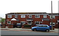
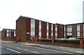
Living in L3 3AT means inhabiting a compact, densely populated postcode area in England, where 2,379 residents occupy just 4,567 square metres. This small cluster is defined by its high population density — 520,875 people per square kilometre — suggesting a tightly knit community. The area’s proximity to multiple schools, rail networks, and ferry terminals underscores its connectivity to surrounding regions. With a median age of 47 and a population skewed toward adults aged 30–64, L3 3AT reflects a mature demographic, likely centred on families and professionals. Daily life here is shaped by the mix of retail, transport, and educational hubs nearby, though the small size of the area means amenities are concentrated. The presence of five primary schools, including Holy Cross Catholic Primary School with a ‘good’ Ofsted rating, and access to rail lines like Liverpool Lime Street Station, positions L3 3AT as a practical choice for those prioritising convenience. However, the area’s compact nature and high density may influence the pace of life, blending urban accessibility with the constraints of limited space.
- Area Type
- Postcode
- Area Size
- 4567 m²
- Population
- 2379
- Population Density
- 3580 people/km²
The property market in L3 3AT is characterised by a low home ownership rate of 23%, suggesting that the area is more rental-oriented than owner-occupied. The predominant accommodation type is houses, which is unusual in a densely populated postcode area. This mix implies that while the area is small, it offers a selection of single-family homes, possibly appealing to those seeking more space in a compact setting. However, the limited number of owner-occupied properties may mean that buyers face competition from renters, with fewer opportunities for purchase. The small size of L3 3AT also means that property availability is constrained, and the immediate surroundings may hold more options. For those considering a move, this area is likely to attract professionals or families prioritising proximity to schools and transport over expansive housing stock. The market may be influenced by the area’s connectivity to rail and ferry networks, which could enhance its appeal despite the limitations of its size.
House Prices in L3 3AT
Showing 1 properties
| Address | Type | Beds | Baths | Last Sale Price | Last Sale Date | |
|---|---|---|---|---|---|---|
| 46 Birkett Street, Liverpool, L3 3AT | Industrial | - | - | - | - |
Energy Efficiency in L3 3AT
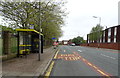
Life in L3 3AT is shaped by its proximity to retail, transport, and leisure hubs. The area’s five retail outlets, including Co-op University of and Tesco Liverpool, provide easy access to groceries and daily essentials. Rail stations such as Liverpool Lime Street Low Level and Moorfields offer connections to major cities, while ferry terminals like Liverpool Pier Head enable travel to the Isle of Man and Dublin. The compact size of the postcode means amenities are closely clustered, reducing travel time for residents. However, the absence of parks or leisure facilities in the data suggests that recreational options may be limited to nearby areas. The mix of schools, shops, and transport links fosters a practical lifestyle, ideal for those prioritising convenience over expansive green spaces. The area’s density and connectivity make it suitable for professionals or families seeking a central location, though the lack of detailed information on leisure amenities may require residents to explore beyond L3 3AT for recreation.
Amenities
Schools
Residents of L3 3AT have access to a range of schools, including Friary Catholic Primary School, Holy Cross Catholic Primary School, Campion Catholic High School, Millstead School, and Roscommon County Primary School. Holy Cross Catholic Primary School holds a ‘good’ Ofsted rating, offering a benchmark of quality for primary education. The mix of primary and special schools, such as Millstead School, caters to diverse educational needs, including those of children with additional requirements. Campion Catholic High School, though listed as a primary school in the data, may indicate a potential oversight or categorisation error. The presence of multiple Catholic schools suggests a community with strong religious affiliations. For families, the proximity of these institutions reduces commuting time, though the density of the area may mean schools are closely clustered. The variety of school types ensures options for different learning preferences, though the lack of secondary schools listed may require residents to seek education beyond the immediate postcode.
| Rank | School | Type | Entry gender | Ages |
|---|
Explore more schools in this area
Go to Schools tabDemographics
The community in L3 3AT is predominantly composed of adults aged 30–64, with a median age of 47. This suggests a population skewed toward middle-aged individuals, possibly reflecting a mix of long-term residents and those in their prime working years. Home ownership here is relatively low at 23%, indicating that a majority of residents are likely renting. The accommodation type is primarily houses, which is notable in a densely populated area, suggesting a focus on single-family homes rather than high-rise or shared housing. The predominant ethnic group is White, though the data does not specify further diversity metrics. The high population density — 520,875 people per square kilometre — implies a compact, possibly urbanised living environment. This density, combined with the low home ownership rate, may point to a rental market dominated by private landlords or housing associations. For buyers, this could mean limited availability of owner-occupied properties, with a greater emphasis on securing long-term leases.
Household Size
Accommodation Type
Tenure
Ethnic Group
Religion
Household Composition
Age
Household Deprivation
NS-SEC
Explore more demographic insights in this area
Go to Demographics tabPlanning
Planning Constraints
- Flood RiskPremium
- Ramsar Wetland SitesPremium
- Area of Outstanding Natural BeautyPremium
- Protected Nature ReservePremium
- Protected WoodlandPremium