Area Overview for L3 2HA
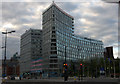
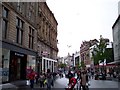
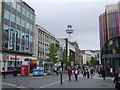
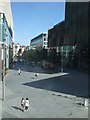
Photos of L3 2HA


Area Information
L3 2HA is a compact residential postcode in England, covering just 1.0 hectare and home to 3,677 residents. Its high population density of 357,238 people per square kilometre reflects a tightly packed urban environment. This area is characterised by its small scale and proximity to transport hubs, making it a practical choice for those prioritising connectivity. The demographic profile suggests a youthful community, with a median age of 22 and the majority of residents aged between 15 and 29. Daily life here is shaped by the prevalence of flats, a low home ownership rate, and a reliance on public transport. The area’s proximity to multiple railway stations, ferry terminals, and retail outlets like Tesco Liverpool ensures convenience for shopping, commuting, and travel. While the compact size limits green spaces, it also fosters a dense network of amenities within walking distance. For buyers, L3 2HA offers a blend of affordability and accessibility, though its small footprint means limited housing options.
- Area Type
- Postcode
- Area Size
- 1.0 hectares
- Population
- 3677
- Population Density
- 21965 people/km²
The property market in L3 2HA is dominated by rental flats, with only 11% of residents owning their homes. This suggests a market primarily catering to tenants rather than buyers seeking long-term ownership. The small area size of 1.0 hectare means housing stock is limited, with little scope for expansion or new developments. The prevalence of flats indicates a focus on affordability and space efficiency, which may appeal to young professionals or students. However, buyers should consider the low home ownership rate as a potential indicator of market saturation or limited demand for private property. The area’s proximity to transport links and amenities may offset its compact size, but the limited housing options mean competition for available properties. For those considering purchase, the market is unlikely to prioritise owner-occupation.
House Prices in L3 2HA
Showing 70 properties
Energy Efficiency in L3 2HA
Living in L3 2HA offers immediate access to essential amenities, including three Tesco Liverpool stores for shopping needs. The area’s transport links are extensive, with five railway stations and five ferry terminals within practical reach, facilitating both daily commutes and weekend getaways. While the compact size limits dedicated green spaces, the proximity to transport hubs and retail outlets ensures a convenient lifestyle. The presence of multiple retail points and transport options reflects a focus on accessibility over leisure. Residents can easily reach cultural and business centres via rail or ferry, though the area itself is more functional than recreational. For those prioritising convenience over expansive amenities, L3 2HA provides a streamlined urban experience.
Amenities
Schools
| Rank | School | Type | Entry gender | Ages |
|---|
Explore more schools in this area
Go to Schools tabDemographics
The community in L3 2HA is overwhelmingly young, with a median age of 22 and 89% of residents falling within the 15–29 age range. This suggests a population skewed towards students, recent graduates, and young professionals. Home ownership is exceptionally low at 11%, indicating that most residents are renters, likely in shared accommodation or purpose-built flats. The accommodation type is predominantly flats, reflecting the area’s high density. The predominant ethnic group is White, though specific diversity metrics are not provided. The high proportion of young adults implies a dynamic, transient community, potentially with a focus on social and professional mobility. However, the low home ownership rate may contribute to a less stable residential environment. For quality of life, the area’s proximity to transport and amenities compensates for its limited private housing stock.
Household Size
Accommodation Type
Tenure
Ethnic Group
Religion
Household Composition
Age
Household Deprivation
NS-SEC
Explore more demographic insights in this area
Go to Demographics tabPlanning
Planning Constraints
- Flood RiskPremium
- Ramsar Wetland SitesPremium
- Area of Outstanding Natural BeautyPremium
- Protected Nature ReservePremium
- Protected WoodlandPremium