Area Overview for L3 1BP
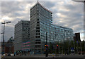
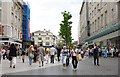
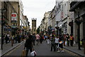
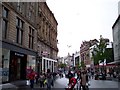
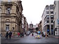
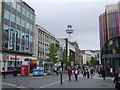
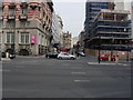
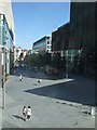
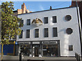
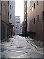
Photos of L3 1BP


Area Information
Living in L3 1BP means inhabiting a compact, densely populated postcode area in England. Covering just 6.1 hectares, this small residential cluster is home to 1,119 people, with a population density of 18,324 people per square kilometre. The area is characterised by its high concentration of flats, reflecting a rental-focused housing stock. Young adults dominate the demographic, with a median age of 22 and 15–29-year-olds making up the majority. This suggests a community shaped by students, recent graduates, or those in transient employment. Daily life here is defined by proximity to urban infrastructure, with rail, ferry, and retail amenities within practical reach. However, the area’s size and density mean it is not suited to those seeking expansive living spaces. L3 1BP is a microcosm of urban living, where convenience comes at the cost of limited private space. Its location within Liverpool offers access to the city’s broader networks, but the area itself remains a tightly knit, high-traffic postcode.
- Area Type
- Postcode
- Area Size
- 6.1 hectares
- Population
- 1119
- Population Density
- 6159 people/km²
The property market in L3 1BP is almost entirely rental-based, with just 15% of residents owning their homes. The area’s housing stock consists almost entirely of flats, which aligns with its high population density and small footprint. This suggests a market geared toward short-term tenancies, likely catering to students, young professionals, or those in transient employment. The limited size of the area—just 6.1 hectares—means the housing stock is constrained, with little scope for expansion. For buyers, this presents challenges: owner-occupied properties are rare, and the focus on flats may not appeal to those seeking larger homes or gardens. The immediate surroundings likely offer similar rental-focused options, reinforcing the area’s role as a transient hub rather than a destination for long-term homeownership.
House Prices in L3 1BP
Showing 49 properties
| Address | Type | Beds | Baths | Last Sale Price | Last Sale Date | |
|---|---|---|---|---|---|---|
| Mann Island Social, 25A Mann Island, Liverpool, L3 1BP | restaurant_cafe | - | - | - | - | |
| Office 5, 17 Mann Island, Liverpool, L3 1BP | Office | - | - | - | - | |
| Office 29, 31 Mann Island, Liverpool, L3 1BP | Office | - | - | - | - | |
| 11A Mann Island, Liverpool, L3 1BP | Restaurant | - | - | - | - | |
| Twelfth Floor, 1 Mann Island, Liverpool, L3 1BP | Office | - | - | - | - | |
| Sixth Floor, 1 Mann Island, Liverpool, L3 1BP | Office | - | - | - | - | |
| Tenth Floor, 1 Mann Island, Liverpool, L3 1BP | Office | - | - | - | - | |
| First Floor, 1 Mann Island, Liverpool, L3 1BP | Office | - | - | - | - | |
| Third Floor, 1 Mann Island, Liverpool, L3 1BP | Office | - | - | - | - | |
| Ninth Floor, 1 Mann Island, Liverpool, L3 1BP | Office | - | - | - | - |
Energy Efficiency in L3 1BP
Life in L3 1BP is shaped by its proximity to retail, rail, and ferry services. Within walking distance are major retailers like Tesco Liverpool and Sainsburys Liverpool, offering everyday shopping needs. Rail stations such as Liverpool Central Loop Line and Moorfields Railway Station provide frequent connections to the city’s business districts and beyond. Ferry terminals, including Liverpool Pier Head and Woodside Birkenhead, open up access to maritime travel, whether for commuting or leisure. The area’s compact nature means amenities are tightly clustered, reducing the need for long journeys. However, the absence of parks or green spaces—no AONB, Ramsar sites, or protected woodlands—suggests a focus on urban convenience over natural recreation. This lifestyle suits those prioritising accessibility and connectivity over expansive outdoor spaces.
Amenities
Schools
| Rank | School | Type | Entry gender | Ages |
|---|
Explore more schools in this area
Go to Schools tabDemographics
The community in L3 1BP is overwhelmingly young, with a median age of 22 and 15–29-year-olds comprising the largest age group. Only 15% of residents own their homes, indicating a rental-dominated market. The accommodation type is predominantly flats, reflecting both the area’s compact size and the transient nature of its population. The predominant ethnic group is White, though the data does not specify further diversity metrics. The high population density—18,324 people per square kilometre—suggests a mix of shared living arrangements and student housing. This demographic profile implies a community with high mobility, where temporary stays or short-term tenancies are common. The low home ownership rate also points to limited long-term investment in property, which may affect local amenities and services tailored to permanent residents.
Household Size
Accommodation Type
Tenure
Ethnic Group
Religion
Household Composition
Age
Household Deprivation
NS-SEC
Explore more demographic insights in this area
Go to Demographics tabPlanning
Planning Constraints
- Flood RiskPremium
- Ramsar Wetland SitesPremium
- Area of Outstanding Natural BeautyPremium
- Protected Nature ReservePremium
- Protected WoodlandPremium