Area Overview for L28 4EH
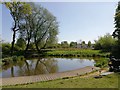
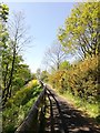
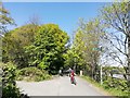
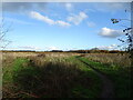
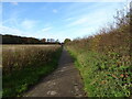
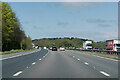
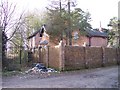
Photos of L28 4EH

Area Information
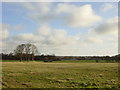
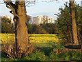
Living in L28 4EH means being part of a small, tightly knit residential cluster in England. The area covers just 2.2 hectares, housing 1,654 people at a density of 126 per square kilometre. This compact footprint suggests a quiet, low-traffic environment, ideal for those seeking a balance between urban proximity and space. The community here is predominantly middle-aged, with a median age of 47 and a strong presence of adults aged 30–64. Most residents own their homes, with 63% of properties in private ownership. The area’s character is defined by its modest scale and the presence of local amenities, including retail outlets and transport links. While it lacks large-scale infrastructure, its proximity to rail stations and ferry terminals offers connectivity to nearby cities like Liverpool. For buyers, this is a niche market—properties are likely to be family homes or long-term investments, with limited scope for speculative development. The area’s appeal lies in its simplicity: a place where daily life is shaped by local needs rather than sprawling urban sprawl.
- Area Type
- Postcode
- Area Size
- 2.2 hectares
- Population
- 1654
- Population Density
- 126 people/km²
The property market in L28 4EH is characterised by a high rate of home ownership, with 63% of properties in private hands. This suggests a community of long-term residents rather than a transient rental market. The accommodation type is predominantly houses, which is typical for areas with low density and a focus on family living. Given the area’s small size—just 2.2 hectares—the housing stock is likely limited, making it a niche market for buyers. The scarcity of properties may mean that homes here are in demand, particularly for those seeking a quiet, established neighbourhood. However, the lack of larger-scale development or commercial zones means that property values are unlikely to be driven by speculative investment. For buyers, this area offers a chance to own a home in a stable, low-traffic environment, though the limited supply could mean competition for available properties. The focus on houses rather than flats or apartments also appeals to those prioritising space and privacy.
House Prices in L28 4EH
Showing 40 properties
| Address | Type | Beds | Baths | Last Sale Price | Last Sale Date | |
|---|---|---|---|---|---|---|
| 131 Boode Croft, Stockbridge Village, L28 4EH | house | - | - | £47,000 | Mar 2018 | |
| 159 Boode Croft, Stockbridge Village, L28 4EH | Terraced | 3 | 1 | £40,500 | Feb 2014 | |
| 152 Boode Croft, Stockbridge Village, L28 4EH | house | 3 | 1 | £55,000 | Aug 2005 | |
| 139 Boode Croft, Stockbridge Village, L28 4EH | Terraced | - | - | £29,000 | Oct 1999 | |
| 128 Boode Croft, Stockbridge Village, L28 4EH | Terraced | 4 | 1 | - | - | |
| 123 Boode Croft, Stockbridge Village, L28 4EH | Terraced | 3 | 1 | - | - | |
| 125 Boode Croft, Stockbridge Village, L28 4EH | house | - | - | - | - | |
| 140 Boode Croft, Stockbridge Village, L28 4EH | Terraced | - | - | - | - | |
| 144 Boode Croft, Stockbridge Village, L28 4EH | house | - | - | - | - | |
| 150 Boode Croft, Stockbridge Village, L28 4EH | house | - | - | - | - |
Energy Efficiency in L28 4EH
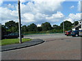
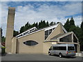
Residents of L28 4EH have access to a range of nearby amenities, including five retail outlets such as Morrisons Daily, Tesco Princess, and Tesco Deysbrook. These stores offer everyday shopping needs, from groceries to household goods. The area’s proximity to rail stations and ferry terminals enhances its connectivity, allowing easy travel to urban centres like Liverpool for leisure, dining, or work. While the data does not mention parks or recreational spaces, the absence of planning constraints such as protected woodlands or AONB designations suggests that the area may have more open space available for development or informal use. The combination of local retail, transport links, and nearby ferry services creates a convenient lifestyle, though residents may need to travel further for specialist amenities. The modest scale of the area means that daily life is shaped by proximity to these key services.
Amenities
Schools
The nearest school to L28 4EH is Knowsley Village School, a primary school with an Ofsted rating of satisfactory. This indicates that the school meets basic standards but may not excel in areas such as pupil outcomes or staff performance. The presence of a primary school is a key consideration for families with young children, though no secondary schools are listed in the data. The limited range of educational institutions suggests that parents may need to look beyond the immediate area for secondary schooling options. For those prioritising proximity to schools, this area offers a basic foundation but may require additional planning for older children’s education. The satisfactory rating means that while the school functions adequately, it may not stand out in competitive local markets.
| Rank | School | Type | Entry gender | Ages |
|---|
Explore more schools in this area
Go to Schools tabDemographics
The population of L28 4EH is 1,654, with a median age of 47. This suggests a mature demographic, with the largest age group being adults aged 30–64. Home ownership is strong, at 63%, indicating a stable, long-term resident base. The accommodation type is predominantly houses, which aligns with the area’s low density and residential character. The predominant ethnic group is White, though no further diversity data is available. The population density of 126 people per square kilometre is relatively low, implying spacious living conditions compared to larger urban areas. This demographic profile reflects a community that values stability and familiarity, with a focus on family-oriented living. The absence of significant deprivation indicators—while not explicitly stated—suggests that residents have access to basic services and infrastructure. However, the data does not provide insight into income levels or socioeconomic variation, so assumptions about quality of life must be made cautiously.
Household Size
Accommodation Type
Tenure
Ethnic Group
Religion
Household Composition
Age
Household Deprivation
NS-SEC
Explore more demographic insights in this area
Go to Demographics tabPlanning
Planning Constraints
- Flood RiskPremium
- Ramsar Wetland SitesPremium
- Area of Outstanding Natural BeautyPremium
- Protected Nature ReservePremium
- Protected WoodlandPremium