Area Overview for L27 7DF
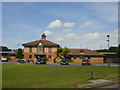
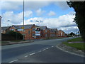
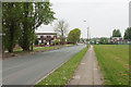
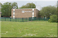
Photos of L27 7DF
Area Information
Living in L27 7DF means inhabiting a compact, densely populated residential cluster in England. With a population of 1,406 spread over just 3,691 square metres, this area is characterised by high population density—380,969 people per square kilometre. Despite its small size, it offers a mix of essential services and connectivity. The community is predominantly composed of adults aged 30–64, with a median age of 47, suggesting a mature, settled population. Daily life here is shaped by proximity to retail, rail networks, and two nearby airports. The area’s compact nature means amenities are within practical reach, though its size limits expansion. For those seeking a quiet, tightly knit environment with access to infrastructure, L27 7DF balances residential comfort with functional connectivity.
- Area Type
- Postcode
- Area Size
- 3691 m²
- Population
- 1406
- Population Density
- 2240 people/km²
The property market in L27 7DF is defined by a 48% home ownership rate, indicating that nearly half of properties are owner-occupied, while the remainder are likely rented. The accommodation type is exclusively houses, which is unusual for a small postcode area but may reflect a focus on single-family homes. This suggests a market skewed towards owner-occupiers seeking stable, long-term housing. However, the limited area size means the housing stock is finite, potentially restricting options for buyers. For those considering the area, proximity to rail networks and retail hubs may outweigh the constraints of a small, saturated market. The predominance of houses also implies a lack of high-density development, which could be a consideration for those needing different property types.
House Prices in L27 7DF
Showing 12 properties
| Address | Type | Beds | Baths | Last Sale Price | Last Sale Date | |
|---|---|---|---|---|---|---|
| 11 Superior Close, Liverpool, L27 7DF | Terraced | 2 | - | £76,000 | Sep 2017 | |
| 6 Superior Close, Liverpool, L27 7DF | Terraced | - | - | £23,950 | Aug 1999 | |
| 9 Superior Close, Liverpool, L27 7DF | Terraced | - | - | - | - | |
| 1 Superior Close, Liverpool, L27 7DF | Terraced | - | - | - | - | |
| 10 Superior Close, Liverpool, L27 7DF | house | - | - | - | - | |
| 5 Superior Close, Liverpool, L27 7DF | house | - | - | - | - | |
| 3 Superior Close, Liverpool, L27 7DF | house | - | - | - | - | |
| 7 Superior Close, Liverpool, L27 7DF | house | - | - | - | - | |
| 4 Superior Close, Liverpool, L27 7DF | Terraced | - | - | - | - | |
| 2 Superior Close, Liverpool, L27 7DF | house | - | - | - | - |
Energy Efficiency in L27 7DF
Lifestyle in L27 7DF is shaped by its proximity to essential amenities. Retail options include Spar, Morrisons Belle, and Iceland Belle, offering convenience for daily shopping. The area’s rail network—served by Huyton, Halewood, and Roby stations—provides easy access to regional transport links, while two Liverpool John Lennon Airport locations cater to travel needs. Though the area is small, its amenities are practical and accessible, supporting a self-sufficient lifestyle. The compact nature of the area means residents can reach shops, transport hubs, and airports without long commutes, though the lack of parks or leisure facilities may require travel for recreational activities.
Amenities
Schools
Residents of L27 7DF have access to two primary schools: St Gregory’s Catholic Primary School and St Gregory’s RC Infant School. Both institutions cater to younger children, with the former holding a ‘good’ Ofsted rating. The presence of two primary schools within the area suggests a focus on early education, though no secondary schools are listed. For families with children, this provides convenience for primary schooling but may necessitate travel for secondary education. The ‘good’ rating at St Gregory’s Catholic Primary School indicates a reliable educational standard, though the absence of diversity in school types—only primary—could be a limitation for those requiring a broader range of educational options.
| Rank | School | Type | Entry gender | Ages |
|---|
Explore more schools in this area
Go to Schools tabDemographics
The demographic profile of L27 7DF reflects a mature, stable community. The median age of 47, with the majority of residents aged 30–64, indicates a population largely in their prime working and family-raising years. Home ownership stands at 48%, suggesting a mix of owner-occupied and rented properties. The accommodation type is predominantly houses, which is notable in a small postcode area. The predominant ethnic group is White, aligning with broader regional trends. The high population density—380,969 people per square kilometre—raises questions about living space per person but is offset by the availability of nearby amenities. This density may influence community interaction but also underscores the need for efficient infrastructure to meet demand.
Household Size
Accommodation Type
Tenure
Ethnic Group
Religion
Household Composition
Age
Household Deprivation
NS-SEC
Explore more demographic insights in this area
Go to Demographics tabPlanning
Planning Constraints
- Flood RiskPremium
- Ramsar Wetland SitesPremium
- Area of Outstanding Natural BeautyPremium
- Protected Nature ReservePremium
- Protected WoodlandPremium