Area Overview for L27 5RZ
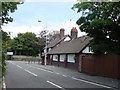
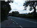
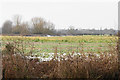
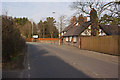
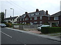
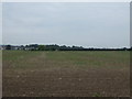
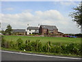
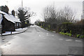
Photos of L27 5RZ
Area Information
Living in L27 5RZ means being part of a tightly knit residential cluster in England, where 1,411 people reside across 4,646 square metres. The area’s high population density—303,673 people per square kilometre—reflects its compact nature, ideal for those seeking a close-knit community. This postcode is characterised by a focus on family living, with the majority of residents aged 30–64, suggesting a stable demographic. The area’s proximity to Cross Farm Primary School and Cross Farm County Infant School makes it appealing for families. Daily life here balances practicality with accessibility, with rail stations like Halewood and Huyton within reach, and retail options such as Spar and Tesco Tarbock nearby. While small, the area’s density and amenities create a self-contained environment, though buyers should consider its limited size when exploring property options.
- Area Type
- Postcode
- Area Size
- 4646 m²
- Population
- 1411
- Population Density
- 6183 people/km²
The property market in L27 5RZ is dominated by owner-occupied homes, with 66% of residents owning their properties. The accommodation type is primarily houses, suggesting a mix of semi-detached and detached homes typical of suburban areas. Given the small size of the postcode—just 4,646 square metres—the housing stock is limited, and buyers may need to look beyond immediate surroundings for more options. The high home ownership rate indicates a stable market, with properties likely retaining value due to low turnover. However, the compact nature of the area means competition for available homes could be intense. For buyers, this small cluster offers a sense of community but requires careful consideration of future growth potential and proximity to larger amenities.
House Prices in L27 5RZ
Showing 8 properties
| Address | Type | Beds | Baths | Last Sale Price | Last Sale Date | |
|---|---|---|---|---|---|---|
| 18 Woodlands Square, Liverpool, L27 5RZ | house | - | - | £55,000 | Oct 2023 | |
| 17 Woodlands Square, Liverpool, L27 5RZ | Terraced | 2 | - | £46,000 | Aug 2014 | |
| 19 Woodlands Square, Liverpool, L27 5RZ | house | - | - | £72,000 | Sep 2006 | |
| 20 Woodlands Square, Liverpool, L27 5RZ | Terraced | - | - | - | - | |
| 21 Woodlands Square, Liverpool, L27 5RZ | house | - | - | - | - | |
| 6 Woodlands Square, Liverpool, L27 5RZ | retail_financial | - | - | - | - | |
| 9 Woodlands Square, Liverpool, L27 5RZ | shop | - | - | - | - | |
| 16 Woodlands Square, Liverpool, L27 5RZ | Terraced | - | - | - | - |
Energy Efficiency in L27 5RZ
Residents of L27 5RZ enjoy a range of amenities within practical reach. Retail options include Spar, Tesco Tarbock, and Aldi Coppice, providing everyday shopping convenience. Rail stations like Halewood and Huyton connect the area to broader networks, while Liverpool John Lennon Airport ensures easy travel. Though the area is small, the density of services means residents can access essentials without long commutes. The presence of multiple retail outlets and transport links contributes to a practical, efficient lifestyle. While parks or leisure facilities are not explicitly mentioned, the proximity to rail and retail suggests a balance between convenience and community needs.
Amenities
Schools
Residents of L27 5RZ have access to two primary schools: Cross Farm Primary School and Cross Farm County Infant School. Both institutions cater to younger children, providing essential early education for families in the area. The presence of two primary schools suggests a focus on foundational education, though no secondary schools are listed in the data. This mix is advantageous for parents seeking proximity to schools for their children, though those requiring secondary education may need to look further afield. The schools’ types align with the community’s demographic, supporting the needs of the 30–64 age group, many of whom are likely parents.
| Rank | School | Type | Entry gender | Ages |
|---|
Explore more schools in this area
Go to Schools tabDemographics
The community in L27 5RZ is predominantly composed of adults aged 30–64, with a median age of 47. This suggests a mature, established population, likely with long-term ties to the area. Home ownership rates stand at 66%, indicating a strong presence of owner-occupied properties, while the accommodation type is primarily houses. The predominant ethnic group is White, reflecting the area’s demographic profile. With no data on deprivation or diversity beyond this, the focus remains on a stable, family-oriented population. The absence of significant age groups under 18 or over 65 implies a community centred on working-age adults, possibly with children attending local primary schools. This profile shapes a neighbourhood where familiarity and routine are key aspects of daily life.
Household Size
Accommodation Type
Tenure
Ethnic Group
Religion
Household Composition
Age
Household Deprivation
NS-SEC
Explore more demographic insights in this area
Go to Demographics tabPlanning
Planning Constraints
- Flood RiskPremium
- Ramsar Wetland SitesPremium
- Area of Outstanding Natural BeautyPremium
- Protected Nature ReservePremium
- Protected WoodlandPremium