Area Overview for L27 5RX
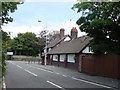
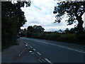
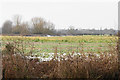
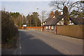
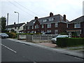
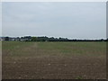
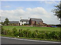
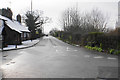
Photos of L27 5RX
Area Information
Living in L27 5RX means being part of a tightly knit, small residential cluster in England, where 1,411 people reside across just 4,854 square metres. The area’s high population density of 290,704 people per square kilometre reflects its compact nature, creating a community where proximity to neighbours is almost inevitable. This postcode is characterised by a mature demographic, with a median age of 47 and a majority of residents aged 30–64. Daily life here is shaped by a balance of stability and practicality, with 66% of homes owned outright, suggesting a community rooted in long-term residency. The presence of two primary schools, Cross Farm Primary and Cross Farm County Infant, underscores the area’s family-friendly appeal. With low flood risk, no protected natural sites, and a crime score of 68 (below average), L27 5RX offers a blend of safety and simplicity. Residents benefit from proximity to rail networks and retail options, making it a practical choice for those prioritising convenience without sacrificing a sense of local identity.
- Area Type
- Postcode
- Area Size
- 4854 m²
- Population
- 1411
- Population Density
- 290704 people/km²
The property market in L27 5RX is dominated by owner-occupied homes, with 66% of properties in private hands. This high rate of home ownership suggests a community where long-term residency is common, and the market is less influenced by rental demand. The predominant accommodation type is houses, which is unusual for a small postcode area but indicates a focus on family-oriented living spaces. Given the area’s limited size, the housing stock is likely to be constrained, meaning buyers should consider nearby zones for more options. The compact nature of L27 5RX also means that property values may be influenced by proximity to amenities such as schools and transport links. For buyers, this presents a trade-off: a stable, low-risk market with limited availability, requiring careful consideration of both location and long-term suitability.
House Prices in L27 5RX
Showing 16 properties
| Address | Type | Beds | Baths | Last Sale Price | Last Sale Date | |
|---|---|---|---|---|---|---|
| 6 Ridsdale Lawn, Liverpool, L27 5RX | house | 3 | 1 | £110,000 | Mar 2024 | |
| 8 Ridsdale Lawn, Liverpool, L27 5RX | house | - | - | £110,000 | Feb 2021 | |
| 12 Ridsdale Lawn, Liverpool, L27 5RX | Terraced | 3 | 1 | £85,000 | May 2019 | |
| 10 Ridsdale Lawn, Liverpool, L27 5RX | house | - | - | £55,000 | Apr 2011 | |
| 14 Ridsdale Lawn, Liverpool, L27 5RX | Terraced | - | - | £64,000 | Mar 2007 | |
| 2 Ridsdale Lawn, Liverpool, L27 5RX | Terraced | - | - | £22,500 | Aug 2000 | |
| 17 Ridsdale Lawn, Liverpool, L27 5RX | house | - | - | - | - | |
| 15 Ridsdale Lawn, Liverpool, L27 5RX | Terraced | - | - | - | - | |
| 4 Ridsdale Lawn, Liverpool, L27 5RX | Terraced | - | - | - | - | |
| 7 Ridsdale Lawn, Liverpool, L27 5RX | Terraced | - | - | - | - |
Energy Efficiency in L27 5RX
Life in L27 5RX is shaped by its proximity to a range of amenities that cater to daily needs. Within walking distance are five retail outlets, including Spar, Tesco Tarbock, and Aldi Coppice, providing access to groceries, convenience items, and local services. The area’s rail network, with five stations including Halewood and Huyton, offers seamless travel to nearby towns and cities. While the data does not mention parks or leisure facilities, the absence of protected natural sites suggests that open spaces may be limited. However, the compact layout of the area means that amenities are clustered closely, reducing the need for long journeys. The presence of two airports nearby adds to the area’s accessibility, making it easier for residents to travel domestically or internationally. This blend of retail, transport, and travel options creates a lifestyle that prioritises convenience and practicality.
Amenities
Schools
Residents of L27 5RX have access to two primary schools: Cross Farm Primary School and Cross Farm County Infant School. Both institutions cater to younger children, providing a foundation for early education within the area. The presence of two primary schools suggests that families with young children can find local options without needing to travel far. However, the data does not include Ofsted ratings for these schools, so prospective parents may need to conduct additional research to assess academic performance and facilities. The concentration of primary education in the area supports a community-oriented approach to schooling, reducing the need for long commutes. For those prioritising proximity to educational institutions, L27 5RX’s schools are a practical asset, though further details on curriculum or extracurricular offerings are not available.
| Rank | School | Type | Entry gender | Ages |
|---|
Explore more schools in this area
Go to Schools tabDemographics
The community in L27 5RX is predominantly composed of adults aged 30–64, with a median age of 47. This suggests a population that is largely established, with many residents likely to have built careers and families in the area. Home ownership is strong, with 66% of properties owned by their occupants, indicating a stable housing market. The accommodation type is primarily houses, reflecting a preference for private, standalone living spaces. The predominant ethnic group is White, which aligns with broader trends in the region. While specific data on deprivation is not provided, the high home ownership rate and low crime risk imply a relatively secure quality of life. The area’s compact size and dense population mean that social interactions are frequent, fostering a close-knit environment. However, the lack of diversity data suggests that the community may be relatively homogeneous compared to larger urban areas.
Household Size
Accommodation Type
Tenure
Ethnic Group
Religion
Household Composition
Age
Household Deprivation
NS-SEC
Explore more demographic insights in this area
Go to Demographics tabPlanning
Planning Constraints
- Flood RiskPremium
- Ramsar Wetland SitesPremium
- Area of Outstanding Natural BeautyPremium
- Protected Nature ReservePremium
- Protected WoodlandPremium