Area Overview for L27 4YE
Photos of L27 4YE
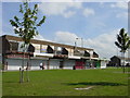
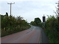
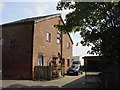
11 photos from this area
Area Information
Key information about the L27 4YE including its size, population, and administrative classification.
- Area Type
- Postcode
- Area Size
- 1.1 hectares
- Population
- 1406
- Population Density
- 2240 people/km²
House Prices in L27 4YE
19
Properties
£145,795
Average Sold Price
£69,950
Lowest Price
£215,000
Highest Price
Showing 19 properties
| Address | Type | Beds | Baths | Last Sale Price | Last Sale Date | |
|---|---|---|---|---|---|---|
| 58 Langshaw Lea, Liverpool, L27 4YE | Terraced | 3 | 2 | £198,000 | Apr 2024 | |
| 56 Langshaw Lea, Liverpool, L27 4YE | Terraced | 3 | 3 | £215,000 | Nov 2023 | |
| 46 Langshaw Lea, Liverpool, L27 4YE | Retail | 3 | 2 | £195,000 | Mar 2023 | |
| 47 Langshaw Lea, Liverpool, L27 4YE | house | - | - | £140,000 | Aug 2021 | |
| 57 Langshaw Lea, Liverpool, L27 4YE | Terraced | 3 | 1 | £152,500 | Sep 2020 | |
| 52 Langshaw Lea, Liverpool, L27 4YE | Detached | 3 | 2 | £155,000 | Jun 2017 | |
| 55 Langshaw Lea, Liverpool, L27 4YE | house | - | - | £132,000 | Jan 2013 | |
| 49 Langshaw Lea, Liverpool, L27 4YE | house | - | - | £105,500 | Oct 2012 | |
| 41 Langshaw Lea, Liverpool, L27 4YE | house | - | - | £95,000 | Oct 2009 | |
| 44 Langshaw Lea, Liverpool, L27 4YE | house | - | - | £69,950 | Jan 2004 |
Page 1 of 2
Energy Efficiency in L27 4YE
Amenities
Schools
| Rank | School | Type | Entry gender | Ages |
|---|
Explore more schools in this area
Go to Schools tabDemographics
Household Size
Family (3-5 people)
most common
Accommodation Type
Houses
most common
Tenure
48
majority
Ethnic Group
White
most common
Religion
N/A
most common
Household Composition
N/A
most common
Age
47
median
Adults (30-64 years)
most common
Household Deprivation
N/A
with no deprivation
NS-SEC
17
in Lower managerial occupations
Explore more demographic insights in this area
Go to Demographics tabPlanning
Planning Constraints
- Flood RiskPremium
- Ramsar Wetland SitesPremium
- Area of Outstanding Natural BeautyPremium
- Protected Nature ReservePremium
- Protected WoodlandPremium