Area Overview for L27 4BD
Photos of L27 4BD
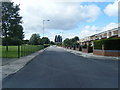
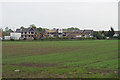
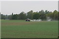
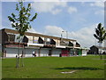
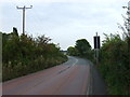
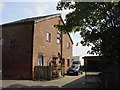
11 photos from this area
Area Information
Key information about the L27 4BD including its size, population, and administrative classification.
- Area Type
- Postcode
- Area Size
- 1.5 hectares
- Population
- 1411
- Population Density
- 6183 people/km²
House Prices in L27 4BD
19
Properties
£95,434
Average Sold Price
£50,000
Lowest Price
£121,000
Highest Price
Showing 19 properties
| Address | Type | Beds | Baths | Last Sale Price | Last Sale Date | |
|---|---|---|---|---|---|---|
| 34 Victoria Falls Road, Liverpool, L27 4BD | Terraced | 3 | 1 | £121,000 | Nov 2022 | |
| 23 Victoria Falls Road, Liverpool, L27 4BD | house | - | - | £116,000 | Dec 2021 | |
| 26 Victoria Falls Road, Liverpool, L27 4BD | house | 3 | 1 | £94,737 | Dec 2006 | |
| 21 Victoria Falls Road, Liverpool, L27 4BD | Terraced | - | - | £50,000 | Oct 2003 | |
| Cross Farm Community Primary School, Victoria Falls Road, Liverpool, L27 4BD | commercial | - | - | - | - | |
| 36 Victoria Falls Road, Liverpool, L27 4BD | house | - | - | - | - | |
| 37 Victoria Falls Road, Liverpool, L27 4BD | house | - | - | - | - | |
| 25 Victoria Falls Road, Liverpool, L27 4BD | house | - | - | - | - | |
| 28 Victoria Falls Road, Liverpool, L27 4BD | house | - | - | - | - | |
| 31 Victoria Falls Road, Liverpool, L27 4BD | Terraced | - | - | - | - |
Page 1 of 2
Energy Efficiency in L27 4BD
Amenities
Schools
| Rank | School | Type | Entry gender | Ages |
|---|
Explore more schools in this area
Go to Schools tabDemographics
Household Size
Family (3-5 people)
most common
Accommodation Type
Houses
most common
Tenure
66
majority
Ethnic Group
White
most common
Religion
N/A
most common
Household Composition
N/A
most common
Age
47
median
Adults (30-64 years)
most common
Household Deprivation
N/A
with no deprivation
NS-SEC
18
in Lower managerial occupations
Explore more demographic insights in this area
Go to Demographics tabPlanning
Planning Constraints
- Flood RiskPremium
- Ramsar Wetland SitesPremium
- Area of Outstanding Natural BeautyPremium
- Protected Nature ReservePremium
- Protected WoodlandPremium