Area Overview for L26 7YH
Photos of L26 7YH
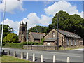
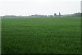
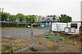
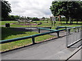
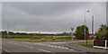
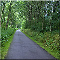
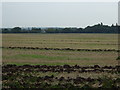
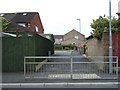
17 photos from this area
Area Information
Key information about the L26 7YH including its size, population, and administrative classification.
- Area Type
- Postcode
- Area Size
- 4478 m²
- Population
- 1332
- Population Density
- 5611 people/km²
House Prices in L26 7YH
13
Properties
£148,550
Average Sold Price
£47,000
Lowest Price
£228,000
Highest Price
Showing 13 properties
| Address | Type | Beds | Baths | Last Sale Price | Last Sale Date | |
|---|---|---|---|---|---|---|
| 6 Portloe Avenue, Halewood, L26 7YH | Detached | 3 | 1 | £228,000 | May 2025 | |
| 19 Portloe Avenue, Halewood, L26 7YH | house | 4 | - | £217,000 | Feb 2021 | |
| 5 Portloe Avenue, Halewood, L26 7YH | Semi-detached | 4 | 2 | £187,500 | May 2020 | |
| 17 Portloe Avenue, Halewood, L26 7YH | house | - | - | £172,000 | Feb 2018 | |
| 21 Portloe Avenue, Halewood, L26 7YH | Semi-detached | 3 | - | £145,000 | Sep 2007 | |
| 15 Portloe Avenue, Halewood, L26 7YH | house | - | - | £132,500 | Aug 2006 | |
| 9 Portloe Avenue, Halewood, L26 7YH | Semi-detached | - | - | £130,000 | May 2005 | |
| 3 Portloe Avenue, Halewood, L26 7YH | Semi-detached | - | - | £77,950 | Nov 2002 | |
| 1 Portloe Avenue, Halewood, L26 7YH | Semi-detached | 3 | 1 | £47,000 | Apr 1995 | |
| 11 Portloe Avenue, Halewood, L26 7YH | Semi-detached | - | - | - | - |
Page 1 of 2
Energy Efficiency in L26 7YH
Amenities
Schools
| Rank | School | Type | Entry gender | Ages |
|---|
Explore more schools in this area
Go to Schools tabDemographics
Household Size
Family (3-5 people)
most common
Accommodation Type
Houses
most common
Tenure
87
majority
Ethnic Group
White
most common
Religion
N/A
most common
Household Composition
N/A
most common
Age
47
median
Adults (30-64 years)
most common
Household Deprivation
N/A
with no deprivation
NS-SEC
32
in Lower managerial occupations
Explore more demographic insights in this area
Go to Demographics tabPlanning
Planning Constraints
- Flood RiskPremium
- Ramsar Wetland SitesPremium
- Area of Outstanding Natural BeautyPremium
- Protected Nature ReservePremium
- Protected WoodlandPremium