Area Overview for L26 7WR
Photos of L26 7WR
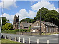
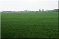
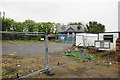
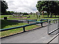
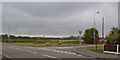
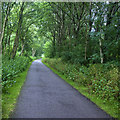
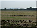
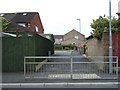
17 photos from this area
Area Information
Key information about the L26 7WR including its size, population, and administrative classification.
- Area Type
- Postcode
- Area Size
- 9955 m²
- Population
- 1388
- Population Density
- 139429 people/km²
House Prices in L26 7WR
24
Properties
£95,980
Average Sold Price
£48,450
Lowest Price
£203,700
Highest Price
Showing 24 properties
| Address | Type | Beds | Baths | Last Sale Price | Last Sale Date | |
|---|---|---|---|---|---|---|
| 4 Turnstone Drive, Halewood, L26 7WR | Semi-detached | 3 | 1 | £203,700 | Nov 2024 | |
| 34 Turnstone Drive, Halewood, L26 7WR | Detached | 3 | - | £186,000 | Nov 2018 | |
| 30 Turnstone Drive, Halewood, L26 7WR | Detached | 3 | - | £175,000 | May 2017 | |
| 22 Turnstone Drive, Halewood, L26 7WR | Semi-detached | 3 | - | £132,500 | Apr 2016 | |
| 52 Turnstone Drive, Halewood, L26 7WR | house | 3 | - | £149,000 | Sep 2011 | |
| 42 Turnstone Drive, Halewood, L26 7WR | house | - | - | £158,000 | Feb 2011 | |
| 38 Turnstone Drive, Halewood, L26 7WR | Semi-detached | - | - | £146,500 | Dec 2006 | |
| 48 Turnstone Drive, Halewood, L26 7WR | Semi-detached | - | - | £98,000 | Mar 2004 | |
| 44 Turnstone Drive, Halewood, L26 7WR | house | - | - | £65,000 | Apr 2002 | |
| 50 Turnstone Drive, Halewood, L26 7WR | Semi-detached | 3 | - | £59,250 | May 2000 |
Page 1 of 3
Energy Efficiency in L26 7WR
Amenities
Schools
| Rank | School | Type | Entry gender | Ages |
|---|
Explore more schools in this area
Go to Schools tabDemographics
Household Size
Two person
most common
Accommodation Type
Houses
most common
Tenure
85
majority
Ethnic Group
White
most common
Religion
N/A
most common
Household Composition
N/A
most common
Age
47
median
Adults (30-64 years)
most common
Household Deprivation
N/A
with no deprivation
NS-SEC
29
in Lower managerial occupations
Explore more demographic insights in this area
Go to Demographics tabPlanning
Planning Constraints
- Flood RiskPremium
- Ramsar Wetland SitesPremium
- Area of Outstanding Natural BeautyPremium
- Protected Nature ReservePremium
- Protected WoodlandPremium