Area Overview for L26 2WZ
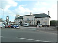
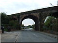
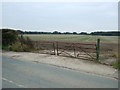
Photos of L26 2WZ

Area Information
Living in L26 2WZ means being part of a tightly knit residential cluster in England, where 2,409 people reside across a population density of 222 people per square kilometre. This small area is characterised by its established housing stock, with most properties being owner-occupied and predominantly houses. The median age of 47 suggests a community of middle-aged adults, many of whom are likely to be settled in long-term residences. Daily life here is shaped by proximity to essential services, including five nearby railway stations and a range of retail outlets. The area’s compact size means amenities are within practical reach, though its small footprint also means it is a focused, self-contained neighbourhood. With no major environmental constraints like protected woodlands or wetlands, the area is free from planning restrictions that might complicate development. However, the moderate crime risk score of 66 means residents should remain vigilant. For those seeking a quiet, stable environment with access to transport and schools, L26 2WZ offers a blend of practicality and convenience.
- Area Type
- Postcode
- Area Size
- Not available
- Population
- 2409
- Population Density
- 222 people/km²
The property market in L26 2WZ is dominated by owner-occupied homes, with 87% of properties owned by residents rather than rented. This high ownership rate points to a community that values long-term investment in housing, often associated with stability and lower turnover. The accommodation type is predominantly houses, which suggests a focus on family-friendly or spacious living arrangements. Given the area’s small size, the housing stock is likely limited, making it a niche market for buyers seeking specific properties. The absence of rental properties or flats implies that the area is not a hotspot for short-term lettings or speculative investment. For buyers, this means competition may be fierce for available homes, and the market is likely to be more about securing a home rather than capitalising on rapid price growth. The compact nature of the area also means that immediate surroundings, such as nearby postcode clusters, may hold more varied housing options.
House Prices in L26 2WZ
No properties found in this postcode.
Energy Efficiency in L26 2WZ
Daily life in L26 2WZ is shaped by its proximity to practical amenities. Retailers like Aldi Halewood, Tesco Liverpool, and Co-op Woolton provide essential shopping options, while the five nearby railway stations offer easy access to broader regional networks. Although the area lacks detailed information on dining or leisure venues, the presence of multiple retail outlets and transport links suggests a functional, convenience-focused lifestyle. The absence of named parks or recreational spaces means it is uncertain whether green spaces are readily available for relaxation or exercise. However, the area’s compact size ensures that most needs can be met without long journeys. For residents prioritising accessibility over sprawling leisure options, L26 2WZ offers a straightforward, no-frills approach to everyday living, with an emphasis on practicality and connectivity.
Amenities
Schools
Residents of L26 2WZ have access to several educational institutions, including Halewood CofE Primary School, which serves younger children, and four special schools: Highfield School, Cartbridge Residential School, Spencer House School, and Finch Woods Academy. The presence of multiple special schools indicates that the area may cater to families with children requiring tailored educational support. However, no information on Ofsted ratings or academic performance is provided, so it is unclear how these schools compare to others in the region. The mix of primary and special schools suggests a diverse educational landscape, though the absence of mainstream secondary schools may require families to travel further for comprehensive education. This could be a consideration for those prioritising a full range of schooling options within walking or driving distance.
| Rank | School | Type | Entry gender | Ages |
|---|
Explore more schools in this area
Go to Schools tabDemographics
The community in L26 2WZ is predominantly composed of adults aged 30–64, with a median age of 47. This suggests a mature, established population, many of whom may be in their peak earning years or nearing retirement. Home ownership is high at 87%, indicating a stable, long-term resident base rather than a transient rental market. The accommodation type is largely houses, which aligns with the area’s residential character and may appeal to families or those seeking more space. The predominant ethnic group is White, though no specific data on diversity or deprivation levels is provided. The absence of detailed diversity metrics means it is unclear whether the community is ethnically homogenous or if minority groups are present. The age profile and ownership rates suggest a low turnover of properties, which can contribute to a sense of continuity. However, the lack of data on deprivation or income levels means it is difficult to assess the area’s economic resilience or access to services beyond what is explicitly stated.
Household Size
Accommodation Type
Tenure
Ethnic Group
Religion
Household Composition
Age
Household Deprivation
NS-SEC
Explore more demographic insights in this area
Go to Demographics tabPlanning
Planning Constraints
- Flood RiskPremium
- Ramsar Wetland SitesPremium
- Area of Outstanding Natural BeautyPremium
- Protected Nature ReservePremium
- Protected WoodlandPremium