Area Overview for L25 9WZ
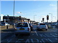
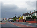
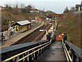
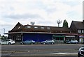
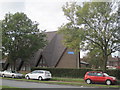
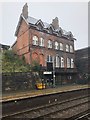
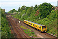
Photos of L25 9WZ


Area Information
Living in L25 9WZ offers a compact, residential experience shaped by its small cluster of homes and proximity to key services. With a population of 1,525, this postcode area is characterised by a quiet, community-oriented atmosphere, where the majority of residents are adults aged 30–64. The area’s housing stock is predominantly composed of houses, reflecting a more traditional, family-friendly layout. Daily life is supported by nearby amenities, including multiple rail stations, retail outlets, and access to two airports within a short distance. The broadband quality here is exceptional, scoring 100, ensuring seamless connectivity for both work and leisure. While the area lacks natural constraints like protected woodlands or Areas of Outstanding Natural Beauty, its practical advantages—such as nearby schools and transport links—make it a viable choice for those prioritising accessibility over rural tranquillity. L25 9WZ is not a sprawling suburb but a focused, manageable community, ideal for those seeking a balance between suburban comfort and urban reach.
- Area Type
- Postcode
- Area Size
- Not available
- Population
- 1525
- Population Density
- 5543 people/km²
The property market in L25 9WZ is defined by its low home ownership rate of 38% and a housing stock dominated by houses. This suggests that the area is not a hotbed for property investment but rather a place where renters outnumber owners. The prevalence of houses over flats or apartments indicates a focus on family-oriented living, with larger properties likely dominating the landscape. For buyers, this dynamic means a smaller pool of available properties, particularly owner-occupied homes. The area’s compact size means that the immediate surroundings are likely to share similar characteristics, with limited scope for expansion. Those considering purchase should be mindful of the lower home ownership rate, which may influence market competition and property turnover. The presence of rail stations and retail hubs nearby adds to the area’s appeal, though the market remains niche, catering more to those prioritising convenience over investment potential.
House Prices in L25 9WZ
No properties found in this postcode.
Energy Efficiency in L25 9WZ
Residents of L25 9WZ enjoy a lifestyle shaped by its proximity to practical amenities. The area’s retail options include Co-op Woolton, Sainsburys Woolton, and Asda Hunts, providing everyday shopping needs within easy reach. Rail stations such as Hunts Cross and Halewood offer direct links to urban centres, facilitating both commuting and leisure travel. The presence of two airports, Liverpool John Lennon Airport, adds to the area’s accessibility for regional and international travel. While the data does not mention parks or leisure facilities, the compact nature of the postcode suggests a focus on functional living rather than expansive recreational spaces. The combination of retail, transport, and air connectivity creates a convenient, efficient lifestyle, ideal for those prioritising accessibility over sprawling green spaces. The area’s small size means that amenities are tightly clustered, reducing the need for long commutes to access services.
Amenities
Schools
Residents of L25 9WZ have access to two special schools: Knowsley Southern Primary Support Centre and Arncliffe School. Both institutions cater to students with specific educational needs, reflecting the area’s focus on inclusive education. While the data does not provide Ofsted ratings, the presence of these schools suggests that families requiring tailored support for their children are well-served. The concentration of special schools may indicate a local demand for specialist resources, though it also means that mainstream schools are not listed in the data. For parents seeking traditional education, the area’s school options are limited to these two institutions. This could be a consideration for families prioritising a broader range of school types. The proximity of these schools to the area underscores their importance as community anchors, though buyers should verify additional educational options beyond the immediate postcode.
| Rank | School | Type | Entry gender | Ages |
|---|
Explore more schools in this area
Go to Schools tabDemographics
The community in L25 9WZ is predominantly composed of adults aged 30–64, with a median age of 47. This suggests a mature population, likely with established careers and families. Home ownership in the area stands at 38%, indicating that a significant portion of residents rent their homes. The accommodation type is primarily houses, which may reflect a preference for larger, more private living spaces. The predominant ethnic group is White, though no specific data on diversity or deprivation is provided. The relatively low home ownership rate could imply a rental market dynamic, where property availability is more fluid. For buyers, this demographic profile suggests a stable, long-term community with fewer transient residents. The absence of detailed diversity metrics means the area’s cultural makeup remains less defined in the data, but the presence of special schools nearby hints at a need for tailored educational services.
Household Size
Accommodation Type
Tenure
Ethnic Group
Religion
Household Composition
Age
Household Deprivation
NS-SEC
Explore more demographic insights in this area
Go to Demographics tabPlanning
Planning Constraints
- Flood RiskPremium
- Ramsar Wetland SitesPremium
- Area of Outstanding Natural BeautyPremium
- Protected Nature ReservePremium
- Protected WoodlandPremium