Area Overview for L25 9QF
Photos of L25 9QF

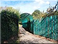
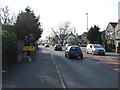
25 photos from this area
Area Information
Key information about the L25 9QF including its size, population, and administrative classification.
- Area Type
- Postcode
- Area Size
- 1.0 hectares
- Population
- 1525
- Population Density
- 5543 people/km²
House Prices in L25 9QF
11
Properties
£257,518
Average Sold Price
£36,500
Lowest Price
£881,989
Highest Price
Showing 11 properties
| Address | Type | Beds | Baths | Last Sale Price | Last Sale Date | |
|---|---|---|---|---|---|---|
| 143 Arncliffe Road, Halewood, L25 9QF | Semi-detached | 3 | 1 | £155,000 | Mar 2025 | |
| 147 Arncliffe Road, Halewood, L25 9QF | Semi-detached | 2 | 3 | £125,000 | Aug 2020 | |
| Arncliffe Court Nursing Home, 147B Arncliffe Road, Halewood, L25 9QF | hospital_care_home | - | - | £881,989 | Aug 2017 | |
| 145 Arncliffe Road, Halewood, L25 9QF | Semi-detached | - | - | £89,100 | May 2003 | |
| 151 Arncliffe Road, Halewood, L25 9QF | house | - | - | £36,500 | Sep 1997 | |
| 149 Arncliffe Road, Halewood, L25 9QF | Semi-detached | - | - | - | - | |
| Speke House, Arncliffe Court Nursing Home, 147B Arncliffe Road, Halewood, L25 9QF | commercial | - | - | - | - | |
| Childwall House, Arncliffe Court Nursing Home, 147B Arncliffe Road, Halewood, L25 9QF | commercial | - | - | - | - | |
| Gateacre House, Arncliffe Court Nursing Home, 147B Arncliffe Road, Halewood, L25 9QF | commercial | - | - | - | - | |
| Garston House, Arncliffe Court Nursing Home, 147B Arncliffe Road, Halewood, L25 9QF | commercial | - | - | - | - |
Page 1 of 2
Energy Efficiency in L25 9QF
Amenities
Schools
| Rank | School | Type | Entry gender | Ages |
|---|
Explore more schools in this area
Go to Schools tabDemographics
Household Size
One person
most common
Accommodation Type
Houses
most common
Tenure
38
majority
Ethnic Group
White
most common
Religion
N/A
most common
Household Composition
N/A
most common
Age
47
median
Adults (30-64 years)
most common
Household Deprivation
N/A
with no deprivation
NS-SEC
18
in Lower managerial occupations
Explore more demographic insights in this area
Go to Demographics tabPlanning
Planning Constraints
- Flood RiskPremium
- Ramsar Wetland SitesPremium
- Area of Outstanding Natural BeautyPremium
- Protected Nature ReservePremium
- Protected WoodlandPremium