Area Overview for L25 8ST
Photos of L25 8ST
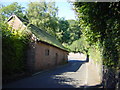
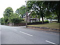


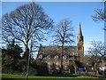
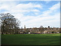
46 photos from this area
Area Information
Key information about the L25 8ST including its size, population, and administrative classification.
- Area Type
- Postcode
- Area Size
- 7114 m²
- Population
- 1434
- Population Density
- 3319 people/km²
House Prices in L25 8ST
26
Properties
£201,081
Average Sold Price
£63,200
Lowest Price
£310,000
Highest Price
Showing 26 properties
| Address | Type | Beds | Baths | Last Sale Price | Last Sale Date | |
|---|---|---|---|---|---|---|
| 43 Charterhouse Road, Liverpool, L25 8ST | Detached | 3 | 1 | £305,000 | Jul 2025 | |
| 27 Charterhouse Road, Liverpool, L25 8ST | Semi-detached | 3 | 1 | £255,000 | Oct 2023 | |
| 33 Charterhouse Road, Liverpool, L25 8ST | Semi-detached | 3 | 1 | £310,000 | Jan 2023 | |
| 37 Charterhouse Road, Liverpool, L25 8ST | Semi-detached | 3 | 1 | £280,000 | Mar 2022 | |
| 7 Charterhouse Road, Liverpool, L25 8ST | house | - | - | £250,000 | Sep 2021 | |
| 39 Charterhouse Road, Liverpool, L25 8ST | house | - | - | £289,000 | Aug 2021 | |
| 23 Charterhouse Road, Liverpool, L25 8ST | Semi-detached | 4 | 2 | £290,000 | Mar 2020 | |
| 35 Charterhouse Road, Liverpool, L25 8ST | house | - | - | £192,750 | Dec 2018 | |
| 59 Charterhouse Road, Liverpool, L25 8ST | Semi-detached | 3 | 1 | £186,500 | May 2017 | |
| 19 Charterhouse Road, Liverpool, L25 8ST | house | - | - | £247,000 | May 2017 |
Page 1 of 3
Energy Efficiency in L25 8ST
Amenities
Schools
| Rank | School | Type | Entry gender | Ages |
|---|
Explore more schools in this area
Go to Schools tabDemographics
Household Size
One person
most common
Accommodation Type
Houses
most common
Tenure
83
majority
Ethnic Group
White
most common
Religion
N/A
most common
Household Composition
N/A
most common
Age
47
median
Adults (30-64 years)
most common
Household Deprivation
N/A
with no deprivation
NS-SEC
36
in Lower managerial occupations
Explore more demographic insights in this area
Go to Demographics tabPlanning
Planning Constraints
- Flood RiskPremium
- Ramsar Wetland SitesPremium
- Area of Outstanding Natural BeautyPremium
- Protected Nature ReservePremium
- Protected WoodlandPremium