Area Overview for L25 7XF
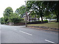
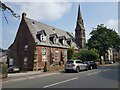
Photos of L25 7XF


Area Information
Living in L25 7XF means being part of a small, tightly knit residential cluster in England, home to 1,687 people. This area is defined by its compact nature, with a focus on practical living rather than sprawling development. The community here is predominantly elderly, with a median age of 47 and a significant proportion of residents aged 65+. Daily life is shaped by proximity to essential services, including five retail outlets such as Tesco Liverpool and Sainsburys Woolton, which cater to local needs. The area’s transport links are a key feature, with five nearby railway stations, including Hunts Cross and Liverpool South Parkway, offering easy access to surrounding cities. Two airports—Liverpool John Lennon Airport—plus three ferry terminals, such as Liverpool Pier Head, provide connectivity for travel and commuting. While the housing stock is primarily flats, the area’s low crime risk and absence of environmental constraints make it an appealing choice for those seeking a quiet, well-served neighbourhood.
- Area Type
- Postcode
- Area Size
- Not available
- Population
- 1687
- Population Density
- 6521 people/km²
The property market in L25 7XF is shaped by its 41% home ownership rate, which indicates that the majority of residents are renters rather than homeowners. This suggests a rental-dominated market, likely influenced by the area’s predominantly flat-based housing stock. Flats are the primary accommodation type, which may appeal to those seeking compact, low-maintenance living. For buyers, this means the available housing is limited to smaller units, potentially making it challenging to find larger properties. The small population and clustered layout of the area also mean that the immediate surroundings offer few alternative options. However, the low crime risk and proximity to transport links could make the area attractive to investors or first-time buyers looking for affordable, secure properties. The market’s character is defined by practicality, with properties designed for convenience rather than luxury.
House Prices in L25 7XF
No properties found in this postcode.
Energy Efficiency in L25 7XF
Residents of L25 7XF have access to a range of amenities within practical reach. The retail sector includes five stores, such as Tesco Liverpool and Sainsburys Woolton, offering everyday shopping needs. The area’s rail network, with stations like Hunts Cross and West Allerton, connects to broader transport systems, while two airports provide easy access to domestic and international travel. Ferry terminals, including Liverpool Pier Head, add to the region’s connectivity, allowing travel to nearby islands and cities. These amenities contribute to a lifestyle that balances convenience with accessibility. The presence of multiple transport options and retail hubs ensures that daily tasks are efficient, reducing the need for long commutes. The character of the area is defined by its practicality, with amenities designed to support both local and broader regional mobility.
Amenities
Schools
| Rank | School | Type | Entry gender | Ages |
|---|
Explore more schools in this area
Go to Schools tabDemographics
The population of L25 7XF is characterised by a median age of 47, with the elderly (65+ years) forming the most common age group. This suggests a community with a significant proportion of retirees or long-term residents. Home ownership rates stand at 41%, indicating that the majority of households are renters, which may influence the local property market dynamics. The accommodation type is predominantly flats, reflecting a housing stock tailored to smaller households or those prioritising convenience over larger living spaces. The predominant ethnic group is White, with no specific data provided on other demographics. The age profile and ownership statistics imply a stable, low-turnover community, where residents may have established roots. The absence of deprivation data means the quality of life can be inferred from the area’s safety and amenity scores, which suggest a balanced, if modest, lifestyle.
Household Size
Accommodation Type
Tenure
Ethnic Group
Religion
Household Composition
Age
Household Deprivation
NS-SEC
Explore more demographic insights in this area
Go to Demographics tabPlanning
Planning Constraints
- Flood RiskPremium
- Ramsar Wetland SitesPremium
- Area of Outstanding Natural BeautyPremium
- Protected Nature ReservePremium
- Protected WoodlandPremium