Area Overview for L25 6DL
Photos of L25 6DL
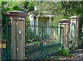
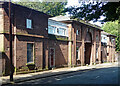
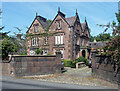
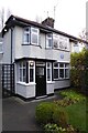
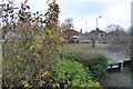
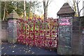
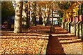
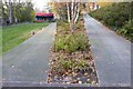
44 photos from this area
Area Information
Key information about the L25 6DL including its size, population, and administrative classification.
- Area Type
- Postcode
- Area Size
- 1.1 hectares
- Population
- 1443
- Population Density
- 4309 people/km²
House Prices in L25 6DL
20
Properties
£210,425
Average Sold Price
£73,000
Lowest Price
£405,000
Highest Price
Showing 20 properties
| Address | Type | Beds | Baths | Last Sale Price | Last Sale Date | |
|---|---|---|---|---|---|---|
| 30 Hightor Road, Liverpool, L25 6DL | Semi-detached | 4 | 1 | £325,000 | Jul 2018 | |
| 16 Hightor Road, Liverpool, L25 6DL | Semi-detached | 4 | 2 | £405,000 | Mar 2017 | |
| 40 Hightor Road, Liverpool, L25 6DL | Detached | 4 | 3 | £265,000 | Jun 2016 | |
| 14 Hightor Road, Liverpool, L25 6DL | Semi-detached | 4 | - | £328,000 | Oct 2013 | |
| 10 Hightor Road, Liverpool, L25 6DL | Semi-detached | 3 | 2 | £192,000 | May 2011 | |
| 20 Hightor Road, Liverpool, L25 6DL | house | 3 | - | £192,000 | May 2011 | |
| 36 Hightor Road, Liverpool, L25 6DL | house | - | - | £200,000 | Dec 2009 | |
| 4 Hightor Road, Liverpool, L25 6DL | house | - | - | £190,000 | Jun 2008 | |
| 26 Hightor Road, Liverpool, L25 6DL | Semi-detached | - | - | £169,000 | Oct 2003 | |
| 38 Hightor Road, Liverpool, L25 6DL | Semi-detached | - | - | £86,100 | Aug 2000 |
Page 1 of 2
Energy Efficiency in L25 6DL
Amenities
Schools
| Rank | School | Type | Entry gender | Ages |
|---|
Explore more schools in this area
Go to Schools tabDemographics
Household Size
Two person
most common
Accommodation Type
Houses
most common
Tenure
81
majority
Ethnic Group
White
most common
Religion
N/A
most common
Household Composition
N/A
most common
Age
47
median
Adults (30-64 years)
most common
Household Deprivation
N/A
with no deprivation
NS-SEC
49
in Lower managerial occupations
Explore more demographic insights in this area
Go to Demographics tabPlanning
Planning Constraints
- Flood RiskPremium
- Ramsar Wetland SitesPremium
- Area of Outstanding Natural BeautyPremium
- Protected Nature ReservePremium
- Protected WoodlandPremium