Area Overview for L25 5NQ
Photos of L25 5NQ
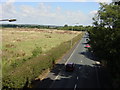
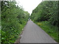
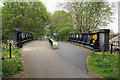
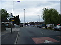
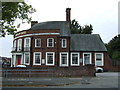
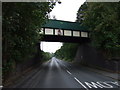

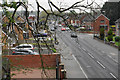
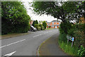
9 photos from this area
Area Information
Key information about the L25 5NQ including its size, population, and administrative classification.
- Area Type
- Postcode
- Area Size
- 1.0 hectares
- Population
- 1276
- Population Density
- 744 people/km²
House Prices in L25 5NQ
14
Properties
£118,150
Average Sold Price
£37,000
Lowest Price
£235,000
Highest Price
Showing 14 properties
| Address | Type | Beds | Baths | Last Sale Price | Last Sale Date | |
|---|---|---|---|---|---|---|
| 27 Lydiate Lane, Halewood, L25 5NQ | house | - | - | £235,000 | Mar 2025 | |
| 15 Lydiate Lane, Halewood, L25 5NQ | Terraced | 2 | 1 | £156,000 | Jan 2024 | |
| 3 Lydiate Lane, Halewood, L25 5NQ | house | 3 | 1 | £162,000 | Apr 2023 | |
| 7 Lydiate Lane, Halewood, L25 5NQ | house | - | - | £80,000 | Jun 2020 | |
| 21 Lydiate Lane, Halewood, L25 5NQ | Terraced | 3 | 1 | £157,500 | Mar 2018 | |
| 11 Lydiate Lane, Halewood, L25 5NQ | Terraced | 2 | 2 | £118,000 | Feb 2016 | |
| 19 Lydiate Lane, Halewood, L25 5NQ | Terraced | 3 | 1 | £83,000 | May 2013 | |
| 25 Lydiate Lane, Halewood, L25 5NQ | house | - | - | £90,000 | Feb 2013 | |
| 23 Lydiate Lane, Halewood, L25 5NQ | Terraced | - | - | £63,000 | Feb 2005 | |
| 9 Lydiate Lane, Halewood, L25 5NQ | Terraced | 4 | 1 | £37,000 | May 1999 |
Page 1 of 2
Energy Efficiency in L25 5NQ
Amenities
Schools
| Rank | School | Type | Entry gender | Ages |
|---|
Explore more schools in this area
Go to Schools tabDemographics
Household Size
Family (3-5 people)
most common
Accommodation Type
Houses
most common
Tenure
72
majority
Ethnic Group
White
most common
Religion
N/A
most common
Household Composition
N/A
most common
Age
47
median
Adults (30-64 years)
most common
Household Deprivation
N/A
with no deprivation
NS-SEC
30
in Lower managerial occupations
Explore more demographic insights in this area
Go to Demographics tabPlanning
Planning Constraints
- Flood RiskPremium
- Ramsar Wetland SitesPremium
- Area of Outstanding Natural BeautyPremium
- Protected Nature ReservePremium
- Protected WoodlandPremium