Area Overview for L25 5LN
Photos of L25 5LN
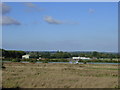
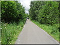
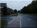
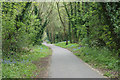
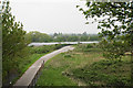
10 photos from this area
Area Information
Key information about the L25 5LN including its size, population, and administrative classification.
- Area Type
- Postcode
- Area Size
- 1.3 hectares
- Population
- 1368
- Population Density
- 6182 people/km²
House Prices in L25 5LN
43
Properties
£131,373
Average Sold Price
£38,000
Lowest Price
£210,000
Highest Price
Showing 43 properties
| Address | Type | Beds | Baths | Last Sale Price | Last Sale Date | |
|---|---|---|---|---|---|---|
| 146 Halewood Road, Liverpool, L25 5LN | house | - | - | £210,000 | Jan 2025 | |
| 180 Halewood Road, Liverpool, L25 5LN | house | - | - | £180,000 | Dec 2024 | |
| 154 Halewood Road, Liverpool, L25 5LN | Semi-detached | 3 | 1 | £181,000 | Mar 2023 | |
| 144 Halewood Road, Liverpool, L25 5LN | Retail | 3 | 1 | £180,000 | Dec 2022 | |
| 124 Halewood Road, Liverpool, L25 5LN | house | - | - | £202,000 | Sep 2021 | |
| 172 Halewood Road, Liverpool, L25 5LN | Terraced | 3 | 1 | £145,000 | Jan 2021 | |
| 142 Halewood Road, Liverpool, L25 5LN | Terraced | 3 | 1 | £169,950 | Jan 2021 | |
| 134 Halewood Road, Liverpool, L25 5LN | Terraced | 3 | 1 | £152,000 | Sep 2018 | |
| 166 Halewood Road, Liverpool, L25 5LN | Terraced | 3 | - | £119,000 | Nov 2017 | |
| 106 Halewood Road, Liverpool, L25 5LN | Terraced | 3 | 1 | £120,000 | Jul 2017 |
Page 1 of 5
Energy Efficiency in L25 5LN
Amenities
Schools
| Rank | School | Type | Entry gender | Ages |
|---|
Explore more schools in this area
Go to Schools tabDemographics
Household Size
One person
most common
Accommodation Type
Houses
most common
Tenure
60
majority
Ethnic Group
White
most common
Religion
N/A
most common
Household Composition
N/A
most common
Age
47
median
Adults (30-64 years)
most common
Household Deprivation
N/A
with no deprivation
NS-SEC
29
in Lower managerial occupations
Explore more demographic insights in this area
Go to Demographics tabPlanning
Planning Constraints
- Flood RiskPremium
- Ramsar Wetland SitesPremium
- Area of Outstanding Natural BeautyPremium
- Protected Nature ReservePremium
- Protected WoodlandPremium