Area Overview for L25 3SE
Photos of L25 3SE

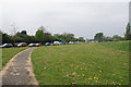
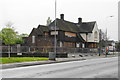

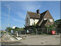
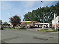
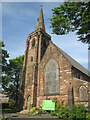
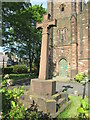
27 photos from this area
Area Information
Key information about the L25 3SE including its size, population, and administrative classification.
- Area Type
- Postcode
- Area Size
- 1.3 hectares
- Population
- 1498
- Population Density
- 6208 people/km²
House Prices in L25 3SE
39
Properties
£89,081
Average Sold Price
£25,000
Lowest Price
£166,000
Highest Price
Showing 39 properties
| Address | Type | Beds | Baths | Last Sale Price | Last Sale Date | |
|---|---|---|---|---|---|---|
| 112 Churchfield Road, Liverpool, L25 3SE | Terraced | 2 | 1 | £137,000 | Feb 2023 | |
| 89 Churchfield Road, Liverpool, L25 3SE | house | - | - | £125,000 | Aug 2022 | |
| 86 Churchfield Road, Liverpool, L25 3SE | Terraced | 3 | 1 | £166,000 | Mar 2022 | |
| 87 Churchfield Road, Liverpool, L25 3SE | Terraced | 4 | 1 | £127,000 | Sep 2019 | |
| 75 Churchfield Road, Liverpool, L25 3SE | Terraced | 2 | 1 | £84,000 | Nov 2018 | |
| 100 Churchfield Road, Liverpool, L25 3SE | Terraced | - | - | £110,000 | Dec 2017 | |
| 82 Churchfield Road, Liverpool, L25 3SE | Terraced | 3 | 1 | £82,000 | Aug 2017 | |
| 102 Churchfield Road, Liverpool, L25 3SE | house | 2 | 1 | £75,000 | Jan 2017 | |
| 73 Churchfield Road, Liverpool, L25 3SE | Terraced | 4 | 1 | £108,000 | Dec 2015 | |
| 96 Churchfield Road, Liverpool, L25 3SE | Terraced | 3 | - | £89,000 | Nov 2014 |
Page 1 of 4
Energy Efficiency in L25 3SE
Amenities
Schools
| Rank | School | Type | Entry gender | Ages |
|---|
Explore more schools in this area
Go to Schools tabDemographics
Household Size
One person
most common
Accommodation Type
Houses
most common
Tenure
48
majority
Ethnic Group
White
most common
Religion
N/A
most common
Household Composition
N/A
most common
Age
47
median
Adults (30-64 years)
most common
Household Deprivation
N/A
with no deprivation
NS-SEC
20
in Lower managerial occupations
Explore more demographic insights in this area
Go to Demographics tabPlanning
Planning Constraints
- Flood RiskPremium
- Ramsar Wetland SitesPremium
- Area of Outstanding Natural BeautyPremium
- Protected Nature ReservePremium
- Protected WoodlandPremium