Area Overview for L25 2UE
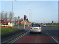
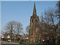
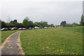
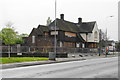
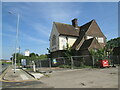
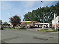
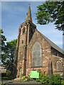
Photos of L25 2UE


Area Information
Living in L25 2UE means being part of a small, tightly knit residential cluster in England, home to 1,584 residents. This area is characterised by its mature population, with a median age of 47 and the majority of residents falling within the 30-64 age range. It is a place where families and established households predominate, reflected in the housing stock, which consists primarily of houses rather than flats. The area’s proximity to multiple railway stations, including Roby and Huyton, and its access to Liverpool John Lennon Airport make it convenient for commuters and travellers. However, the community faces a notable challenge: a high crime risk, with a safety score of 1/100. Despite this, the area benefits from excellent digital connectivity, with a broadband score of 99 and a mobile coverage score of 85, ensuring reliable internet access for both work and leisure. For those seeking a quiet, residential environment with practical transport links, L25 2UE offers a mix of convenience and challenges.
- Area Type
- Postcode
- Area Size
- Not available
- Population
- 1584
- Population Density
- 3175 people/km²
The property market in L25 2UE is defined by its low home ownership rate of 34%, suggesting that rental properties dominate the housing stock. The area consists mainly of houses, which are typically larger and more suited to families than flats. This makes it a niche market, particularly for buyers seeking owner-occupied homes, as the limited number of properties for sale may create competition. The small size of the area means that the immediate surroundings are likely to have similar housing characteristics, with few alternative options for buyers. For those considering purchasing, the focus would be on securing one of the few available houses, which may be in high demand due to the area’s practical transport links and proximity to amenities.
House Prices in L25 2UE
No properties found in this postcode.
Energy Efficiency in L25 2UE
The lifestyle in L25 2UE is shaped by its proximity to essential amenities, including retail outlets like Iceland Belle, Farmfoods Belle, and Morrisons Belle, which provide everyday shopping convenience. The area’s railway stations, such as Roby and Huyton, offer easy access to public transport, while nearby airports and ferry terminals, such as Liverpool John Lennon Airport and Liverpool Pier Head Ferry Terminal, cater to travel needs. These facilities contribute to a practical, connected lifestyle, allowing residents to balance local convenience with broader mobility. The mix of retail, transport, and travel options ensures that daily life in L25 2UE is both functional and accessible.
Amenities
Schools
Residents of L25 2UE have access to a range of educational institutions, including Joseph Williams Junior Mixed and Infant School, a primary school, and Wheathill School, a special school. Two additional primary schools, St Cyril of Jerusalem RC Junior School and St Cyril of Jerusalem RC Infant School, provide early years and primary education. The presence of both mainstream and special schools indicates a commitment to supporting diverse educational needs within the community. Families with children benefit from a choice of schools, though the specific Ofsted ratings for these institutions are not provided. The availability of multiple primary schools may reduce travel time for younger children, while the special school caters to students with specific learning requirements.
| Rank | School | Type | Entry gender | Ages |
|---|
Explore more schools in this area
Go to Schools tabDemographics
The community in L25 2UE is predominantly composed of adults aged 30-64, with a median age of 47. This suggests a population of established professionals and families, rather than a younger or elderly demographic. Home ownership is relatively low at 34%, indicating that the majority of residents rent their homes. The accommodation type is primarily houses, which aligns with the area’s character as a residential cluster. The predominant ethnic group is White, though no further breakdown of diversity is provided. The small population of 1,584 means the area is not densely populated, offering a quieter, more intimate living environment. However, the lack of data on deprivation or socioeconomic diversity means that the full picture of quality of life remains partially obscured.
Household Size
Accommodation Type
Tenure
Ethnic Group
Religion
Household Composition
Age
Household Deprivation
NS-SEC
Explore more demographic insights in this area
Go to Demographics tabPlanning
Planning Constraints
- Flood RiskPremium
- Ramsar Wetland SitesPremium
- Area of Outstanding Natural BeautyPremium
- Protected Nature ReservePremium
- Protected WoodlandPremium