Area Overview for L25 2NW
Photos of L25 2NW

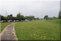
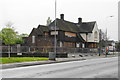

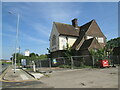
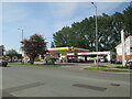
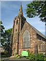
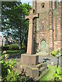
27 photos from this area
Area Information
Key information about the L25 2NW including its size, population, and administrative classification.
- Area Type
- Postcode
- Area Size
- 1.5 hectares
- Population
- 1584
- Population Density
- 3175 people/km²
House Prices in L25 2NW
44
Properties
£83,244
Average Sold Price
£29,000
Lowest Price
£135,000
Highest Price
Showing 44 properties
| Address | Type | Beds | Baths | Last Sale Price | Last Sale Date | |
|---|---|---|---|---|---|---|
| 55 Abbeyvale Drive, Liverpool, L25 2NW | house | - | - | £135,000 | Jan 2021 | |
| 75 Abbeyvale Drive, Liverpool, L25 2NW | house | - | - | £102,000 | Jan 2020 | |
| 37 Abbeyvale Drive, Liverpool, L25 2NW | Terraced | 3 | - | £110,000 | Jan 2018 | |
| 29 Abbeyvale Drive, Liverpool, L25 2NW | house | - | - | £95,000 | Mar 2016 | |
| 33 Abbeyvale Drive, Liverpool, L25 2NW | Terraced | - | - | £99,950 | Mar 2008 | |
| 99 Abbeyvale Drive, Liverpool, L25 2NW | Semi-detached | - | - | £53,000 | Jan 2003 | |
| 59 Abbeyvale Drive, Liverpool, L25 2NW | house | - | - | £42,000 | Dec 2000 | |
| 49 Abbeyvale Drive, Liverpool, L25 2NW | Terraced | - | - | £29,000 | Jan 1999 | |
| 65 Abbeyvale Drive, Liverpool, L25 2NW | Semi-detached | - | - | - | - | |
| 69 Abbeyvale Drive, Liverpool, L25 2NW | Semi-detached | - | - | - | - |
Page 1 of 5
Energy Efficiency in L25 2NW
Amenities
Schools
| Rank | School | Type | Entry gender | Ages |
|---|
Explore more schools in this area
Go to Schools tabDemographics
Household Size
One person
most common
Accommodation Type
Houses
most common
Tenure
34
majority
Ethnic Group
White
most common
Religion
N/A
most common
Household Composition
N/A
most common
Age
47
median
Adults (30-64 years)
most common
Household Deprivation
N/A
with no deprivation
NS-SEC
16
in Lower managerial occupations
Explore more demographic insights in this area
Go to Demographics tabPlanning
Planning Constraints
- Flood RiskPremium
- Ramsar Wetland SitesPremium
- Area of Outstanding Natural BeautyPremium
- Protected Nature ReservePremium
- Protected WoodlandPremium