Area Overview for L25 1NZ
Photos of L25 1NZ
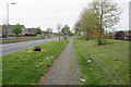
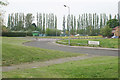
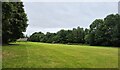
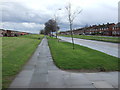
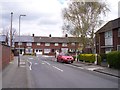
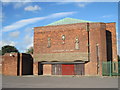
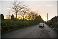
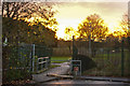
16 photos from this area
Area Information
Key information about the L25 1NZ including its size, population, and administrative classification.
- Area Type
- Postcode
- Area Size
- 1.4 hectares
- Population
- 1160
- Population Density
- 5070 people/km²
House Prices in L25 1NZ
28
Properties
£113,538
Average Sold Price
£35,000
Lowest Price
£141,000
Highest Price
Showing 28 properties
| Address | Type | Beds | Baths | Last Sale Price | Last Sale Date | |
|---|---|---|---|---|---|---|
| 118 Cranwell Road, Liverpool, L25 1NZ | Terraced | 2 | 1 | £130,000 | Feb 2022 | |
| 126 Cranwell Road, Liverpool, L25 1NZ | Terraced | 2 | 1 | £103,500 | Jul 2020 | |
| 108 Cranwell Road, Liverpool, L25 1NZ | Terraced | 3 | 1 | £133,000 | Aug 2019 | |
| 102 Cranwell Road, Liverpool, L25 1NZ | Terraced | 3 | 1 | £141,000 | Jul 2019 | |
| 92 Cranwell Road, Liverpool, L25 1NZ | Terraced | 3 | 1 | £128,000 | Apr 2019 | |
| 90 Cranwell Road, Liverpool, L25 1NZ | Terraced | 3 | 1 | £130,000 | Aug 2018 | |
| 124 Cranwell Road, Liverpool, L25 1NZ | Terraced | 3 | 1 | £127,500 | Sep 2017 | |
| 106 Cranwell Road, Liverpool, L25 1NZ | Terraced | 3 | 1 | £135,000 | Aug 2017 | |
| 94 Cranwell Road, Liverpool, L25 1NZ | house | 3 | - | £96,000 | Apr 2017 | |
| 112 Cranwell Road, Liverpool, L25 1NZ | house | - | - | £98,000 | Apr 2014 |
Page 1 of 3
Energy Efficiency in L25 1NZ
Amenities
Schools
| Rank | School | Type | Entry gender | Ages |
|---|
Explore more schools in this area
Go to Schools tabDemographics
Household Size
One person
most common
Accommodation Type
Houses
most common
Tenure
50
majority
Ethnic Group
White
most common
Religion
N/A
most common
Household Composition
N/A
most common
Age
47
median
Adults (30-64 years)
most common
Household Deprivation
N/A
with no deprivation
NS-SEC
20
in Lower managerial occupations
Explore more demographic insights in this area
Go to Demographics tabPlanning
Planning Constraints
- Flood RiskPremium
- Ramsar Wetland SitesPremium
- Area of Outstanding Natural BeautyPremium
- Protected Nature ReservePremium
- Protected WoodlandPremium