Area Overview for L25 0PH
Photos of L25 0PH

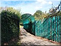
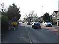
25 photos from this area
Area Information
Key information about the L25 0PH including its size, population, and administrative classification.
- Area Type
- Postcode
- Area Size
- 9585 m²
- Population
- 1269
- Population Density
- 2997 people/km²
House Prices in L25 0PH
31
Properties
£128,686
Average Sold Price
£42,000
Lowest Price
£220,000
Highest Price
Showing 31 properties
| Address | Type | Beds | Baths | Last Sale Price | Last Sale Date | |
|---|---|---|---|---|---|---|
| 103 Laxton Road, Liverpool, L25 0PH | Semi-detached | 3 | 1 | £220,000 | Nov 2025 | |
| 105 Laxton Road, Liverpool, L25 0PH | Semi-detached | 3 | 1 | £198,000 | Jun 2024 | |
| 59 Laxton Road, Liverpool, L25 0PH | Terraced | 3 | 1 | £145,000 | Jul 2023 | |
| 91 Laxton Road, Liverpool, L25 0PH | Terraced | 3 | 1 | £176,000 | Jul 2023 | |
| 81 Laxton Road, Liverpool, L25 0PH | house | 3 | 1 | £162,500 | Oct 2021 | |
| 71 Laxton Road, Liverpool, L25 0PH | Semi-detached | 3 | 1 | £160,000 | May 2021 | |
| 49 Laxton Road, Liverpool, L25 0PH | Terraced | 3 | 1 | £145,000 | May 2021 | |
| 65 Laxton Road, Liverpool, L25 0PH | Terraced | 3 | 1 | £155,000 | Aug 2019 | |
| 99 Laxton Road, Liverpool, L25 0PH | Semi-detached | 3 | 1 | £132,500 | Nov 2017 | |
| 77 Laxton Road, Liverpool, L25 0PH | Semi-detached | 3 | 1 | £130,000 | May 2017 |
Page 1 of 4
Energy Efficiency in L25 0PH
Amenities
Schools
| Rank | School | Type | Entry gender | Ages |
|---|
Explore more schools in this area
Go to Schools tabDemographics
Household Size
Family (3-5 people)
most common
Accommodation Type
Houses
most common
Tenure
84
majority
Ethnic Group
White
most common
Religion
N/A
most common
Household Composition
N/A
most common
Age
47
median
Adults (30-64 years)
most common
Household Deprivation
N/A
with no deprivation
NS-SEC
31
in Lower managerial occupations
Explore more demographic insights in this area
Go to Demographics tabPlanning
Planning Constraints
- Flood RiskPremium
- Ramsar Wetland SitesPremium
- Area of Outstanding Natural BeautyPremium
- Protected Nature ReservePremium
- Protected WoodlandPremium