Area Overview for L23 9TY
Photos of L23 9TY
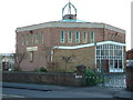
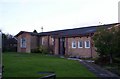
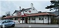

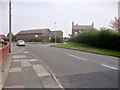
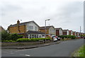
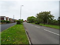
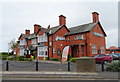
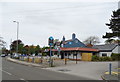
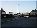
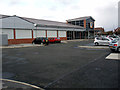
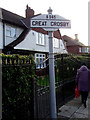
26 photos from this area
Area Information
Key information about the L23 9TY including its size, population, and administrative classification.
- Area Type
- Postcode
- Area Size
- 1.0 hectares
- Population
- 1376
- Population Density
- 2170 people/km²
House Prices in L23 9TY
30
Properties
£179,067
Average Sold Price
£63,500
Lowest Price
£435,000
Highest Price
Showing 30 properties
| Address | Type | Beds | Baths | Last Sale Price | Last Sale Date | |
|---|---|---|---|---|---|---|
| 19 Cranfield Road, Crosby, L23 9TY | Semi-detached | 4 | 2 | £435,000 | Dec 2024 | |
| 33 Cranfield Road, Crosby, L23 9TY | house | - | - | £265,000 | Feb 2022 | |
| 9 Cranfield Road, Crosby, L23 9TY | house | 3 | - | £197,000 | Mar 2021 | |
| 11 Cranfield Road, Crosby, L23 9TY | house | - | - | £123,750 | Sep 2020 | |
| 3 Cranfield Road, Crosby, L23 9TY | Semi-detached | 3 | 1 | £298,000 | May 2020 | |
| 1 Cranfield Road, Crosby, L23 9TY | Semi-detached | 3 | 1 | £220,000 | Nov 2019 | |
| 29 Cranfield Road, Crosby, L23 9TY | Semi-detached | 3 | 1 | £188,000 | Aug 2019 | |
| 37 Cranfield Road, Crosby, L23 9TY | Semi-detached | 3 | 1 | £210,000 | Feb 2017 | |
| 51 Cranfield Road, Crosby, L23 9TY | Semi-detached | 3 | 1 | £140,000 | Aug 2015 | |
| 31 Cranfield Road, Crosby, L23 9TY | house | 3 | - | £186,000 | Nov 2012 |
Page 1 of 3
Energy Efficiency in L23 9TY
Amenities
Schools
| Rank | School | Type | Entry gender | Ages |
|---|
Explore more schools in this area
Go to Schools tabDemographics
Household Size
Family (3-5 people)
most common
Accommodation Type
Houses
most common
Tenure
92
majority
Ethnic Group
White
most common
Religion
N/A
most common
Household Composition
N/A
most common
Age
47
median
Adults (30-64 years)
most common
Household Deprivation
N/A
with no deprivation
NS-SEC
45
in Lower managerial occupations
Explore more demographic insights in this area
Go to Demographics tabPlanning
Planning Constraints
- Flood RiskPremium
- Ramsar Wetland SitesPremium
- Area of Outstanding Natural BeautyPremium
- Protected Nature ReservePremium
- Protected WoodlandPremium