Area Overview for L23 7YL
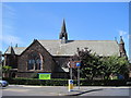
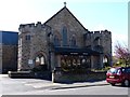
Photos of L23 7YL


Area Information
Living in L23 7YL offers a quiet, residential lifestyle within a small cluster of homes in England. With a population of 1,386, the area is compact but well-served by nearby amenities. The community is predominantly composed of adults aged 30–64, many of whom own their homes. This postcode is characterised by a mix of independent schools and accessible transport links, making it suitable for families and professionals. Daily life here is shaped by proximity to retail hubs like Co-op Mersey and major railway stations such as Blundellsands & Crosby. The area’s low crime risk and strong broadband connectivity further enhance its appeal. While it lacks large-scale infrastructure, its small size fosters a close-knit environment. Residents benefit from a balance of convenience and tranquillity, with easy access to ferry services and nearby schools. For those seeking a stable, family-friendly neighbourhood with practical amenities, L23 7YL provides a compelling option.
- Area Type
- Postcode
- Area Size
- Not available
- Population
- 1386
- Population Density
- 6149 people/km²
The property market in L23 7YL is dominated by owner-occupied homes, with 82% of residents living in properties they own. This high rate of home ownership suggests a stable, long-term community with limited rental activity. The accommodation type is primarily houses, which are more common than flats or apartments. This makes the area attractive to families seeking spacious, private living. Given the small size of the postcode, the housing stock is likely limited, but the focus on owner-occupied properties may indicate strong demand from local residents. Buyers should consider that the area’s compact nature means property choices are concentrated, but the presence of nearby amenities like schools and transport links could enhance its appeal. For those prioritising a family-friendly environment with a sense of permanence, L23 7YL offers a viable option.
House Prices in L23 7YL
No properties found in this postcode.
Energy Efficiency in L23 7YL
Residents of L23 7YL have access to a range of amenities within practical reach. Retail options include major supermarkets like Tesco Crosby and Tesco Liverpool, as well as Co-op Mersey, ensuring everyday shopping needs are met. The area’s railway stations connect to nearby towns, while ferry terminals offer direct links to Belfast, the Isle of Man, and Dublin, broadening travel possibilities. While the data does not specify parks or leisure facilities, the presence of independent schools and transport hubs suggests a focus on education and connectivity. The compact nature of the postcode means amenities are concentrated, reducing the need for long commutes. This blend of retail, transport, and regional access contributes to a lifestyle that balances convenience with the quiet charm of a small residential area.
Amenities
Schools
The schools near L23 7YL include St. Mary’s College, Merchant Taylors’ Girls’ School, and Stanfield Merchant Taylors Junior School for Girls’ and Pre-Prep, all of which are independent institutions. These schools cater to a range of educational stages, from early years to secondary education, providing families with a continuum of private schooling options. The presence of multiple independent schools suggests a demand for non-state education, which may align with the area’s demographic profile of established, middle-aged residents. While no Ofsted ratings are provided, the concentration of independent schools indicates a focus on academic and extracurricular excellence. Families prioritising private education will find this cluster of schools a significant advantage, though those seeking state-funded options may need to look further afield.
| Rank | School | Type | Entry gender | Ages |
|---|
Explore more schools in this area
Go to Schools tabDemographics
The demographic profile of L23 7YL reflects a mature community, with a median age of 47 and the majority of residents falling within the 30–64 age range. Home ownership is high, at 82%, indicating a strong presence of long-term residents. The area is primarily composed of houses, suggesting a focus on family homes rather than flats or apartments. The predominant ethnic group is White, and the data does not indicate significant diversity beyond this. The absence of specific deprivation data means the quality of life is inferred from factors like safety and infrastructure. The low crime risk score of 76/100 underscores a secure environment, while the age profile suggests a stable, established population. This combination of demographics creates a community where familiarity and continuity are key, with fewer transient residents compared to more urban areas.
Household Size
Accommodation Type
Tenure
Ethnic Group
Religion
Household Composition
Age
Household Deprivation
NS-SEC
Explore more demographic insights in this area
Go to Demographics tabPlanning
Planning Constraints
- Flood RiskPremium
- Ramsar Wetland SitesPremium
- Area of Outstanding Natural BeautyPremium
- Protected Nature ReservePremium
- Protected WoodlandPremium