Area Overview for L23 7UA
Photos of L23 7UA
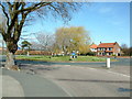
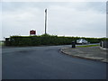
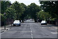
36 photos from this area
Area Information
Key information about the L23 7UA including its size, population, and administrative classification.
- Area Type
- Postcode
- Area Size
- 1.0 hectares
- Population
- 1366
- Population Density
- 4738 people/km²
House Prices in L23 7UA
21
Properties
£271,933
Average Sold Price
£75,000
Lowest Price
£447,500
Highest Price
Showing 21 properties
| Address | Type | Beds | Baths | Last Sale Price | Last Sale Date | |
|---|---|---|---|---|---|---|
| 82 Cambridge Road, Crosby, L23 7UA | Semi-detached | 5 | - | £447,500 | Feb 2023 | |
| 100 Cambridge Road, Crosby, L23 7UA | Semi-detached | 4 | - | £250,000 | Sep 2009 | |
| 98 Cambridge Road, Crosby, L23 7UA | house | - | - | £330,000 | Apr 2009 | |
| 114 Cambridge Road, Crosby, L23 7UA | Semi-detached | - | - | £291,000 | Aug 2006 | |
| 122 Cambridge Road, Crosby, L23 7UA | house | - | - | £375,000 | Dec 2005 | |
| 86 Cambridge Road, Crosby, L23 7UA | Semi-detached | - | - | £289,000 | Aug 2003 | |
| 88 Cambridge Road, Crosby, L23 7UA | Semi-detached | - | - | £249,950 | Jun 2003 | |
| 118 Cambridge Road, Crosby, L23 7UA | Semi-detached | - | - | £139,950 | Jun 2000 | |
| 116 Cambridge Road, Crosby, L23 7UA | Semi-detached | - | - | £75,000 | Apr 1999 | |
| 94 Cambridge Road, Crosby, L23 7UA | Detached | - | - | - | - |
Page 1 of 3
Energy Efficiency in L23 7UA
Amenities
Schools
| Rank | School | Type | Entry gender | Ages |
|---|
Explore more schools in this area
Go to Schools tabDemographics
Household Size
Family (3-5 people)
most common
Accommodation Type
Houses
most common
Tenure
93
majority
Ethnic Group
White
most common
Religion
N/A
most common
Household Composition
N/A
most common
Age
47
median
Adults (30-64 years)
most common
Household Deprivation
N/A
with no deprivation
NS-SEC
51
in Lower managerial occupations
Explore more demographic insights in this area
Go to Demographics tabPlanning
Planning Constraints
- Flood RiskPremium
- Ramsar Wetland SitesPremium
- Area of Outstanding Natural BeautyPremium
- Protected Nature ReservePremium
- Protected WoodlandPremium