Area Overview for L23 6WR
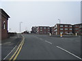
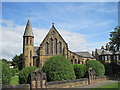
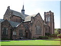
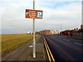
Photos of L23 6WR


Area Information
Living in L23 6WR means being part of a tightly knit residential cluster in England, where 1,433 people reside across a compact area. The population density of 1,254 people per square kilometre reflects a community that is both close-knit and efficient in its use of space. This postcode is characterised by a balance of practicality and accessibility, with residents benefiting from proximity to key services and transport links. The area’s small size means daily life is centred around local amenities, with a focus on convenience rather than sprawling suburban sprawl. While it lacks the anonymity of larger urban zones, it offers a sense of familiarity, where neighbours are likely to be known by name. The mix of residential flats and proximity to retail, rail, and ferry networks ensures that essential needs are met without long commutes. For those seeking a place where community and practicality coexist, L23 6WR presents a distinct alternative to both rural isolation and city congestion.
- Area Type
- Postcode
- Area Size
- Not available
- Population
- 1433
- Population Density
- 1254 people/km²
The property market in L23 6WR is defined by a high rate of home ownership—78% of residents own their homes—indicating a preference for long-term investment over rental living. The predominant accommodation type is flats, which aligns with the area’s compact layout and high population density. This suggests a housing stock tailored to urban living, with limited scope for larger properties or detached homes. For buyers, this means the market is likely to be competitive, with limited availability of new builds or conversions. The small size of the postcode area also means that property searches must extend to nearby zones for more options. Given the high ownership rate, rental properties may be scarce, making L23 6WR more appealing to those seeking a permanent home rather than a short-term lease. The focus on flats also implies a need for proximity to shared amenities, such as communal spaces or local services.
House Prices in L23 6WR
No properties found in this postcode.
Energy Efficiency in L23 6WR
Residents of L23 6WR enjoy a range of amenities within practical reach, enhancing daily life. The area’s retail options include major chains like Tesco Crosby and Farmfoods Crosby, providing convenience for grocery shopping. Nearby rail stations such as Hall Road and Waterloo offer easy access to commuting and regional travel. Ferry terminals, including Liverpool Belfast Ferry Terminal and Seacombe Ferry Terminal, connect the area to key destinations, adding to its accessibility. While the data does not specify dining or leisure venues, the presence of multiple retail and transport hubs suggests a lifestyle that prioritises practicality and connectivity. The compact nature of the area means that essential services are close at hand, reducing the need for long journeys. This blend of retail, transport, and ferry access creates a functional environment where residents can manage daily tasks efficiently.
Amenities
Schools
Residents of L23 6WR have access to three notable schools within practical reach. St Nicholas Church of England Primary School and Ursuline Catholic Primary School are both state-funded institutions with Ofsted ratings of ‘good’, offering reliable education for younger children. These schools provide a mix of faith-based and secular options, catering to diverse family preferences. Nearby is St Mary’s Preparatory School, an independent institution, which offers a private alternative for those seeking smaller class sizes or specific curricula. The presence of both state and independent schools ensures families have choices, whether prioritising affordability or specialised education. For parents, the combination of high-quality state schools and private options reflects a well-rounded educational landscape. The ‘good’ Ofsted ratings for the primary schools indicate consistent performance, which is crucial for families relying on local education.
| Rank | School | Type | Entry gender | Ages |
|---|
Explore more schools in this area
Go to Schools tabDemographics
The community in L23 6WR is predominantly composed of adults aged 30–64, with a median age of 47. This suggests a mature population, likely with established careers and family structures. Home ownership is high, with 78% of residents owning their homes, indicating a stable housing market and a preference for long-term residency. The accommodation type is largely flats, reflecting a compact living environment suited to the area’s density. The predominant ethnic group is White, though no specific data on diversity or deprivation is provided, meaning the community’s social composition remains largely unquantified. The age profile and ownership rates suggest a population focused on stability rather than transient lifestyles. For families or professionals seeking a settled environment, the area’s demographic makeup aligns with a need for reliability and continuity. However, the lack of detailed diversity metrics means broader social dynamics remain unspecified.
Household Size
Accommodation Type
Tenure
Ethnic Group
Religion
Household Composition
Age
Household Deprivation
NS-SEC
Explore more demographic insights in this area
Go to Demographics tabPlanning
Planning Constraints
- Flood RiskPremium
- Ramsar Wetland SitesPremium
- Area of Outstanding Natural BeautyPremium
- Protected Nature ReservePremium
- Protected WoodlandPremium