Area Overview for L23 5TF
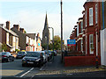
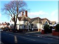
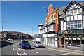
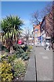
Photos of L23 5TF
Area Information
Living in L23 5TF means inhabiting a tightly knit residential cluster in England, where 1,578 people reside across just 2.8 hectares. The area’s high population density of 57,298 people per square kilometre reflects its compact nature, typical of small urban enclaves. This postcode is defined by its proximity to essential services and transport links, making it a practical choice for those prioritising convenience. The median age of 47 suggests a mature community, with the majority of residents aged between 30 and 64. Daily life here is shaped by the balance of residential tranquillity and accessible infrastructure, from nearby schools to rail networks. While the area is small, its strategic location offers a mix of local amenities and broader connectivity, catering to both commuters and those seeking a settled lifestyle. The predominance of owner-occupied homes and the focus on single-family dwellings indicate a community rooted in stability and long-term residency.
- Area Type
- Postcode
- Area Size
- 2.8 hectares
- Population
- 1578
- Population Density
- 4571 people/km²
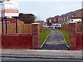
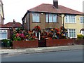
The property market in L23 5TF is characterised by a high rate of home ownership (71%), indicating a strong preference for owner-occupied housing. The accommodation type is predominantly houses, which is unusual for a small postcode area but may reflect the presence of larger, detached properties. This suggests a housing stock that caters to families or individuals seeking space, though the limited area size means the overall number of homes is constrained. For buyers, this means competition for available properties and a focus on existing stock rather than new developments. The high home ownership rate also implies a stable market with long-term residents, which can reduce turnover and maintain property values. However, the small area size means buyers must consider proximity to surrounding neighbourhoods for additional options. The mix of houses and the compact nature of the postcode may appeal to those prioritising privacy and space within a connected urban setting.
House Prices in L23 5TF
No properties found in this postcode.
Energy Efficiency in L23 5TF
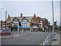
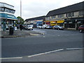
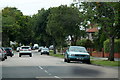
The lifestyle in L23 5TF is shaped by its proximity to essential amenities. Retail options include major chains like Tesco Crosby, Farmfoods Crosby, and Tesco Liverpool, ensuring access to groceries and daily necessities. The area’s rail network, with stations such as Hall Road and Waterloo, facilitates easy travel to surrounding towns and cities. Ferry services, including Liverpool Belfast and Seacombe terminals, provide additional mobility, particularly for those relying on maritime routes. While the area itself is small, its strategic location means residents can access a broader range of services beyond immediate reach. The mix of retail, transport, and connectivity options contributes to a practical, convenience-driven lifestyle, ideal for those prioritising accessibility over expansive local facilities.
Amenities
Schools
The schools near L23 5TF include Great Crosby Catholic Primary School and Sacred Heart Catholic College, both rated ‘good’ by Ofsted. These primary schools offer a range of educational options for younger children. For special needs education, Chestnut Tree School and Olsen House School are available, with Olsen House holding a ‘good’ rating. Sacred Heart Catholic Academy, an academy, has a ‘satisfactory’ rating. This mix of school types provides families with choices, from mainstream primary education to specialist provisions. The presence of multiple schools within reach suggests a focus on accessible education, though the ratings vary. Parents seeking high-performing schools may prioritise Great Crosby Catholic Primary or Olsen House, while those requiring special needs support can rely on the dedicated institutions. The diversity of options reflects the area’s role in catering to different educational needs.
| Rank | School | Type | Entry gender | Ages |
|---|
Explore more schools in this area
Go to Schools tabDemographics
The demographic profile of L23 5TF is marked by a median age of 47, with the majority of residents falling within the 30-64 age range. This suggests a community of established adults, likely with families or long-term careers. Home ownership is high at 71%, reflecting a preference for property investment over rental living. The accommodation type is predominantly houses, which aligns with the area’s compact size and focus on single-family units. The predominant ethnic group is White, though specific data on diversity is not provided. The population density of 57,298 people per square kilometre is exceptionally high, indicating a densely populated environment. This density may influence local dynamics, such as the availability of shared spaces or community interaction. The absence of detailed deprivation data means the quality of life cannot be fully contextualised, but the high home ownership rate and age profile suggest a stable, low-turnover community.
Household Size
Accommodation Type
Tenure
Ethnic Group
Religion
Household Composition
Age
Household Deprivation
NS-SEC
Explore more demographic insights in this area
Go to Demographics tabPlanning
Planning Constraints
- Flood RiskPremium
- Ramsar Wetland SitesPremium
- Area of Outstanding Natural BeautyPremium
- Protected Nature ReservePremium
- Protected WoodlandPremium