Area Overview for L23 5RF
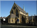
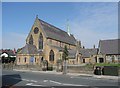
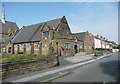
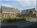
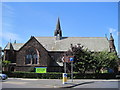
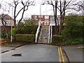
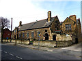
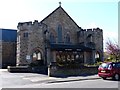
Photos of L23 5RF

Area Information
Living in L23 5RF means inhabiting a tightly packed residential cluster in England, where 1,474 people reside across just 442 square metres. The area’s high population density of 3,331,125 people per square kilometre suggests a compact, community-oriented environment. Daily life here is shaped by proximity to essential services and transport links. The area’s mix of retail, rail, and ferry access ensures convenience, while nearby schools and amenities cater to both families and commuters. With a median age of 47 and a population skewed towards adults aged 30–64, the community is likely stable, with a focus on established households. The presence of independent and state schools, along with a strong retail footprint, indicates a balance between local needs and broader connectivity. While the area is small, its strategic location near major transport routes and services makes it appealing for those prioritising accessibility over expansive space.
- Area Type
- Postcode
- Area Size
- 442 m²
- Population
- 1474
- Population Density
- 6592 people/km²
The property market in L23 5RF is characterised by a high rate of home ownership (75%) and a predominance of houses. This suggests a market skewed towards owner-occupiers rather than renters, with properties likely designed for family living. The compact size of the area means housing stock is limited, and buyers should consider proximity to amenities and transport as key factors. The presence of houses rather than flats or apartments indicates a focus on private, spacious living, which may appeal to those prioritising security and long-term investment. However, the small area size also means competition for properties could be fierce, and buyers may need to look beyond immediate surroundings for more options. The market’s stability is reinforced by the community’s established demographic profile.
House Prices in L23 5RF
No properties found in this postcode.
Energy Efficiency in L23 5RF
Daily life in L23 5RF is supported by a range of nearby amenities. Retail options include major supermarkets like Tesco Crosby, Sainsburys Crosby, and Farmfoods Crosby, ensuring easy access to groceries and daily essentials. The area’s rail network, with stations such as Hall Road and Waterloo, connects residents to broader transport systems, while ferry terminals offer direct links to Liverpool, Belfast, and the Isle of Man. Though the data does not mention parks or leisure facilities, the proximity to retail and transport suggests a practical, service-oriented lifestyle. The compact nature of the area means amenities are within walking or short driving distance, fostering a sense of convenience and community cohesion.
Amenities
Schools
Residents of L23 5RF have access to two notable schools. St Luke’s Halsall Church of England Primary School, a state-funded institution with an Ofsted rating of ‘good’, provides quality primary education. Nearby is Atherton House School, an independent institution offering alternative educational pathways. The combination of state and independent options gives families flexibility, whether they prioritise affordability or specialised curricula. For primary education, the ‘good’ rating at St Luke’s suggests reliable standards, while Atherton House caters to those seeking private schooling. However, the absence of secondary schools in the data means families may need to look further afield for high school options. The schools’ proximity to the area underscores its appeal for families.
| Rank | School | Type | Entry gender | Ages |
|---|
Explore more schools in this area
Go to Schools tabDemographics
The population of L23 5RF is predominantly adults aged 30–64, with a median age of 47. This suggests a mature, established community with a focus on family life and long-term residency. Home ownership is high, at 75%, indicating a stable housing market with a strong presence of owner-occupied properties. The accommodation type is primarily houses, which aligns with the area’s compact layout and suggests a preference for single-family living. The predominant ethnic group is White, reflecting a homogenous demographic profile. While no specific deprivation data is provided, the high home ownership and age range imply a community with relatively stable economic conditions. The absence of detailed diversity metrics means the area’s social fabric is likely shaped by long-standing local traditions and networks.
Household Size
Accommodation Type
Tenure
Ethnic Group
Religion
Household Composition
Age
Household Deprivation
NS-SEC
Explore more demographic insights in this area
Go to Demographics tabPlanning
Planning Constraints
- Flood RiskPremium
- Ramsar Wetland SitesPremium
- Area of Outstanding Natural BeautyPremium
- Protected Nature ReservePremium
- Protected WoodlandPremium