Area Overview for L23 2UU
Photos of L23 2UU
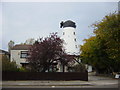
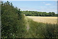
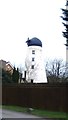
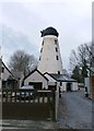
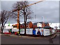
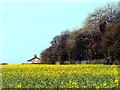
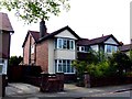
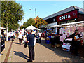
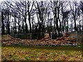
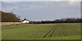
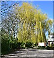
52 photos from this area
Area Information
Key information about the L23 2UU including its size, population, and administrative classification.
- Area Type
- Postcode
- Area Size
- 7073 m²
- Population
- 1256
- Population Density
- 5400 people/km²
House Prices in L23 2UU
22
Properties
£180,614
Average Sold Price
£67,500
Lowest Price
£370,000
Highest Price
Showing 22 properties
| Address | Type | Beds | Baths | Last Sale Price | Last Sale Date | |
|---|---|---|---|---|---|---|
| 21 Chetwood Avenue, Crosby, L23 2UU | house | - | - | £370,000 | Sep 2021 | |
| 25 Chetwood Avenue, Crosby, L23 2UU | house | - | - | £265,000 | Aug 2021 | |
| 37 Chetwood Avenue, Crosby, L23 2UU | house | - | - | £253,000 | Apr 2021 | |
| 17 Chetwood Avenue, Crosby, L23 2UU | house | - | - | £202,500 | Nov 2015 | |
| 1 Chetwood Avenue, Crosby, L23 2UU | house | - | - | £232,000 | Nov 2012 | |
| 35 Chetwood Avenue, Crosby, L23 2UU | Detached | 4 | 2 | £235,000 | Apr 2007 | |
| 19 Chetwood Avenue, Crosby, L23 2UU | Semi-detached | - | - | £145,000 | Feb 2003 | |
| 5 Chetwood Avenue, Crosby, L23 2UU | Semi-detached | - | - | £69,250 | Jun 1999 | |
| 3 Chetwood Avenue, Crosby, L23 2UU | Semi-detached | 3 | - | £78,000 | Sep 1997 | |
| 43 Chetwood Avenue, Crosby, L23 2UU | Semi-detached | - | - | £69,500 | Apr 1997 |
Page 1 of 3
Energy Efficiency in L23 2UU
Amenities
Schools
| Rank | School | Type | Entry gender | Ages |
|---|
Explore more schools in this area
Go to Schools tabDemographics
Household Size
Two person
most common
Accommodation Type
Houses
most common
Tenure
89
majority
Ethnic Group
White
most common
Religion
N/A
most common
Household Composition
N/A
most common
Age
47
median
Adults (30-64 years)
most common
Household Deprivation
N/A
with no deprivation
NS-SEC
47
in Lower managerial occupations
Explore more demographic insights in this area
Go to Demographics tabPlanning
Planning Constraints
- Flood RiskPremium
- Ramsar Wetland SitesPremium
- Area of Outstanding Natural BeautyPremium
- Protected Nature ReservePremium
- Protected WoodlandPremium