Area Overview for L23 2UH
Photos of L23 2UH

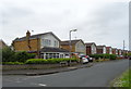
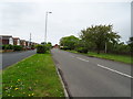
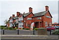
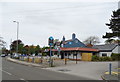
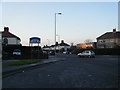

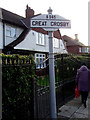
26 photos from this area
Area Information
Key information about the L23 2UH including its size, population, and administrative classification.
- Area Type
- Postcode
- Area Size
- 1.4 hectares
- Population
- 1376
- Population Density
- 2170 people/km²
House Prices in L23 2UH
19
Properties
£236,050
Average Sold Price
£82,000
Lowest Price
£375,000
Highest Price
Showing 19 properties
| Address | Type | Beds | Baths | Last Sale Price | Last Sale Date | |
|---|---|---|---|---|---|---|
| 204 Moor Lane, Crosby, L23 2UH | Detached | 3 | 1 | £375,000 | May 2025 | |
| 196 Moor Lane, Crosby, L23 2UH | Semi-detached | 5 | 1 | £315,000 | Sep 2018 | |
| 214 Moor Lane, Crosby, L23 2UH | Semi-detached | - | - | £370,000 | Jan 2018 | |
| 200 Moor Lane, Crosby, L23 2UH | Semi-detached | 3 | - | £315,000 | Jul 2016 | |
| 208 Moor Lane, Crosby, L23 2UH | Semi-detached | - | - | £285,000 | Apr 2011 | |
| 194 Moor Lane, Crosby, L23 2UH | house | - | - | £250,000 | Aug 2010 | |
| 202 Moor Lane, Crosby, L23 2UH | Semi-detached | - | - | £162,000 | Jul 2001 | |
| 222 Moor Lane, Crosby, L23 2UH | Semi-detached | - | - | £82,000 | Mar 2001 | |
| 226 Moor Lane, Crosby, L23 2UH | Flat | 2 | 1 | £91,500 | May 2000 | |
| 216 Moor Lane, Crosby, L23 2UH | Semi-detached | - | - | £115,000 | Jul 1997 |
Page 1 of 2
Energy Efficiency in L23 2UH
Amenities
Schools
| Rank | School | Type | Entry gender | Ages |
|---|
Explore more schools in this area
Go to Schools tabDemographics
Household Size
Family (3-5 people)
most common
Accommodation Type
Houses
most common
Tenure
92
majority
Ethnic Group
White
most common
Religion
N/A
most common
Household Composition
N/A
most common
Age
47
median
Adults (30-64 years)
most common
Household Deprivation
N/A
with no deprivation
NS-SEC
45
in Lower managerial occupations
Explore more demographic insights in this area
Go to Demographics tabPlanning
Planning Constraints
- Flood RiskPremium
- Ramsar Wetland SitesPremium
- Area of Outstanding Natural BeautyPremium
- Protected Nature ReservePremium
- Protected WoodlandPremium