Area Overview for L23 0XU
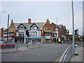
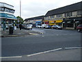
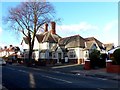
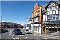
Photos of L23 0XU


Area Information
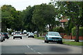
Living in L23 0XU means being part of a small, tightly knit residential cluster in England, home to 1,543 residents. This area is defined by its compact size and proximity to key transport routes, making it a practical choice for those seeking a balance between suburban comfort and accessibility. The community is predominantly composed of adults aged 30–64, with a median age of 47, suggesting a mature, stable population. Daily life here is shaped by the surrounding infrastructure, including multiple rail stations and ferry terminals, which connect residents to nearby cities and coastal destinations. The area’s low crime risk—scoring 88/100—adds to its appeal, offering a sense of security. While there are no protected natural sites or flood-prone zones, the absence of planning constraints means development is unlikely to disrupt the local character. For buyers, L23 0XU presents an opportunity to own a home in a place where practicality meets quiet living, with easy access to retail, transport, and coastal amenities.
- Area Type
- Postcode
- Area Size
- Not available
- Population
- 1543
- Population Density
- 6075 people/km²
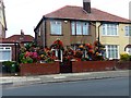
The property market in L23 0XU is characterised by high home ownership—86% of residents own their homes—indicating a strong preference for long-term investment over rental tenancies. The accommodation type is predominantly houses, which is typical of smaller, residential clusters where larger properties dominate. This suggests a market skewed towards owner-occupied homes rather than a rental-focused area. For buyers, this means a potential focus on family homes or properties with gardens, given the absence of high-density housing. The small size of the area and its proximity to transport links may also mean that properties here are in demand from those seeking a balance between privacy and accessibility. With no planning constraints from protected sites or flood risks, the market is likely to remain stable, though the limited population size means inventory is unlikely to be extensive.
House Prices in L23 0XU
No properties found in this postcode.
Energy Efficiency in L23 0XU
Residents of L23 0XU have access to a range of amenities that support both everyday needs and leisure activities. Retail options include multiple Tesco stores and Farmfoods Crosby, ensuring convenient shopping for groceries and essentials. The area’s rail network, with stations like Waterloo Railway Station and Seaforth & Litherland Railway Station, provides easy access to urban centres and regional hubs. For those who enjoy water-based travel, ferry terminals such as Liverpool Belfast Ferry Terminal Bootle and Seacombe Ferry Terminal offer direct connections to coastal towns and islands. While the area lacks large parks or entertainment venues, its proximity to transport links and retail hubs suggests a lifestyle focused on practicality and accessibility. The presence of multiple rail and ferry options also implies a community that values mobility, whether for commuting, weekend trips, or exploring nearby attractions.
Amenities
Schools
| Rank | School | Type | Entry gender | Ages |
|---|
Explore more schools in this area
Go to Schools tabDemographics
The population of L23 0XU is 1,543, with a median age of 47 and the majority of residents falling within the 30–64 age range. This suggests a community of working-age adults and older homeowners, likely contributing to a stable, low-turnover housing market. Home ownership is high, at 86%, indicating a strong preference for long-term residency over rental properties. The accommodation type is predominantly houses, reflecting a suburban or semi-rural setting rather than high-density living. The predominant ethnic group is White, which aligns with broader demographic trends in the region. The low crime risk score of 88/100 underscores the area’s safety, a factor that could influence family-oriented buyers. While no specific deprivation data is provided, the high home ownership and mature age profile suggest a community with established economic stability and limited reliance on social support systems.
Household Size
Accommodation Type
Tenure
Ethnic Group
Religion
Household Composition
Age
Household Deprivation
NS-SEC
Explore more demographic insights in this area
Go to Demographics tabPlanning
Planning Constraints
- Flood RiskPremium
- Ramsar Wetland SitesPremium
- Area of Outstanding Natural BeautyPremium
- Protected Nature ReservePremium
- Protected WoodlandPremium