Area Overview for L22 9QT
Photos of L22 9QT
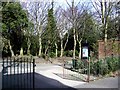
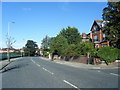
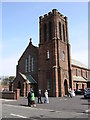
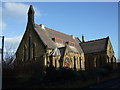
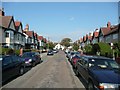
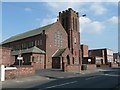
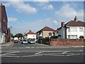
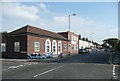
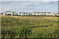
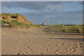
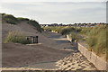
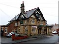
100 photos from this area
Area Information
Key information about the L22 9QT including its size, population, and administrative classification.
- Area Type
- Postcode
- Area Size
- 4606 m²
- Population
- 1506
- Population Density
- 7481 people/km²
House Prices in L22 9QT
26
Properties
£155,238
Average Sold Price
£43,000
Lowest Price
£300,000
Highest Price
Showing 26 properties
| Address | Type | Beds | Baths | Last Sale Price | Last Sale Date | |
|---|---|---|---|---|---|---|
| 45 Ashdale Road, Waterloo, L22 9QT | Terraced | 4 | 2 | £300,000 | Jul 2025 | |
| 15 Ashdale Road, Waterloo, L22 9QT | Semi-detached | 4 | 1 | £232,500 | Dec 2023 | |
| 47 Ashdale Road, Waterloo, L22 9QT | Retail | 4 | 2 | £243,500 | Dec 2022 | |
| 51 Ashdale Road, Waterloo, L22 9QT | house | - | - | £280,000 | Mar 2022 | |
| 31 Ashdale Road, Waterloo, L22 9QT | Terraced | 4 | 1 | £190,000 | Aug 2020 | |
| 39 Ashdale Road, Waterloo, L22 9QT | Terraced | 4 | 1 | £195,000 | Jul 2018 | |
| 7 Ashdale Road, Waterloo, L22 9QT | Terraced | 4 | 1 | £175,000 | May 2018 | |
| 41 Ashdale Road, Waterloo, L22 9QT | Terraced | 4 | 1 | £160,000 | Sep 2017 | |
| 23 Ashdale Road, Waterloo, L22 9QT | house | 4 | 1 | £140,000 | Jul 2016 | |
| 17 Ashdale Road, Waterloo, L22 9QT | Terraced | 4 | - | £160,000 | Nov 2015 |
Page 1 of 3
Energy Efficiency in L22 9QT
Amenities
Schools
| Rank | School | Type | Entry gender | Ages |
|---|
Explore more schools in this area
Go to Schools tabDemographics
Household Size
Family (3-5 people)
most common
Accommodation Type
Houses
most common
Tenure
76
majority
Ethnic Group
White
most common
Religion
N/A
most common
Household Composition
N/A
most common
Age
47
median
Adults (30-64 years)
most common
Household Deprivation
N/A
with no deprivation
NS-SEC
34
in Lower managerial occupations
Explore more demographic insights in this area
Go to Demographics tabPlanning
Planning Constraints
- Flood RiskPremium
- Ramsar Wetland SitesPremium
- Area of Outstanding Natural BeautyPremium
- Protected Nature ReservePremium
- Protected WoodlandPremium