Area Overview for L22 7SF
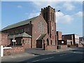
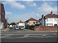
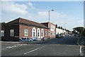
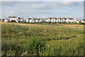
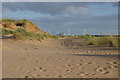
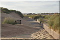
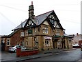
Photos of L22 7SF

Area Information
Living in L22 7SF means being part of a small, tightly knit residential cluster in England with a population of 1,531. This area is characterised by its compact size and focus on housing, with most properties being homes rather than flats or apartments. The community is predominantly composed of adults aged 30–64, reflecting a mature demographic with a median age of 47. Daily life here is shaped by proximity to essential services, including retail stores, railway stations, and ferry terminals, which provide both local convenience and regional connectivity. The area’s low flood risk and absence of environmental constraints like protected woodlands or Ramsar wetlands make it a stable place to live. While it lacks the density of larger urban centres, its accessibility to nearby transport hubs and amenities ensures a balance between seclusion and practicality. For those seeking a quieter, family-friendly environment with minimal planning restrictions, L22 7SF offers a straightforward, low-maintenance lifestyle.
- Area Type
- Postcode
- Area Size
- Not available
- Population
- 1531
- Population Density
- 1959 people/km²
The property market in L22 7SF is defined by a high rate of home ownership—60% of residents own their homes—which suggests a stable, long-term population. The area is predominantly composed of houses rather than flats or apartments, indicating a focus on family-sized dwellings and a lack of high-density housing. This makes the area more attractive to buyers seeking traditional, spacious properties rather than rental opportunities. Given the small size of the postcode and the prevalence of owner-occupied homes, the market is likely limited in scope, with fewer properties available for purchase compared to larger urban areas. Buyers should consider nearby regions for additional options, but L22 7SF itself offers a straightforward, low-maintenance housing stock that aligns with its mature demographic.
House Prices in L22 7SF
No properties found in this postcode.
Energy Efficiency in L22 7SF
Residents of L22 7SF have access to a range of amenities within practical reach. The area includes five retail outlets, such as Co-op Waterloo, Iceland Waterloo, and Tesco Liverpool, offering everyday shopping needs. For transport, five railway stations—Waterloo Railway Station, Blundellsands & Crosby Railway Station, and Hall Road Railway Station—provide connections to nearby towns and cities. Ferry terminals like Liverpool Belfast Ferry Terminal Bootle and Seacombe Ferry Terminal offer links to surrounding areas, including the Isle of Man and Dublin. While the area lacks large parks or leisure facilities, its proximity to transport hubs and essential services ensures a convenient lifestyle. The combination of retail options, rail access, and ferry services supports both daily errands and broader mobility, making L22 7SF a practical choice for those prioritising accessibility over expansive leisure options.
Amenities
Schools
| Rank | School | Type | Entry gender | Ages |
|---|
Explore more schools in this area
Go to Schools tabDemographics
The community in L22 7SF is primarily composed of adults aged 30–64, with a median age of 47. This suggests a population that is largely established, with fewer young families or retirees compared to other areas. Home ownership is high at 60%, indicating a strong presence of long-term residents. The accommodation type is predominantly houses, which aligns with the area’s small, residential character. The predominant ethnic group is White, reflecting a homogenous demographic profile. There is no data on deprivation levels, but the absence of significant planning constraints and the presence of nearby amenities suggest a quality of life that supports both daily needs and long-term stability. The age distribution and ownership rates imply a community focused on maintaining property values and a settled way of life.
Household Size
Accommodation Type
Tenure
Ethnic Group
Religion
Household Composition
Age
Household Deprivation
NS-SEC
Explore more demographic insights in this area
Go to Demographics tabPlanning
Planning Constraints
- Flood RiskPremium
- Ramsar Wetland SitesPremium
- Area of Outstanding Natural BeautyPremium
- Protected Nature ReservePremium
- Protected WoodlandPremium